History of Lake, Porter, and LaPorte, 1927County history published by the Historians' Association . . . .
Source Citation:
Cannon, Thomas H., H. H. Loring, and Charles J. Robb. 1927.
History of
the Lake and Calumet Region of Indiana, Embracing the Counties of Lake,
Porter and LaPorte: An Historical Account of Its People and Its Progress
from the Earliest Times to the Present.
Volume I. Indianapolis, Indiana: Historians' Association. 840 p.
HISTORY OF THE LAKE AND CALUMET REGION OF INDIANA
CHAPTER XXIII.
THE DUNES OF NORTHWESTERN INDIANA.
THE DUNE AREA -- THE GLACIAL PERIOD -- LAKE KANKAKEE -- MORAINES -- LAKE
CHICAGO -- FORMATION OF THE DUNES -- THE GREAT HEIGHT AND AREA -- SANDLAND
BY GEORGE E. BOWEN -- FLORA OF THE DUNES BY GEORGE PINNEO -- THE DUNES PARK.
599
THE DUNES OF NORTHWESTERN INDIANA.
Prepared by A. F. Knotts of Gary
for the Indiana State Geological Department
The Dunes Region of northwestern Indiana consists of two parts. First, that occupying the portion of the old bed and shore of the so-called “Lake Kankakee,” lying mostly south of the present Kankakee River and marsh; second, that portion of the old “Lake Chicago” bed and shore lying between the present Lake Michigan shore and the Valparaiso Moraine.
The first part extends east, approximately, to the western boundaries of Marshall and Fulton Counties, south as far as Monticello in White County, and west to the state line and beyond. There are portions of this territory, of course, not covered by Sand Dunes. The “Lake Kankakee” sand dune country in Indiana and Illinois covers more than three thousand square miles. More than two thousand square miles of this area is in Indiana.
When the last great glaciers came down from the north, they came to northwestern Indiana in three great lobes. The one from the north is known as the Lake Michigan lobe, the one from the northeast as the Saginaw lobe, and the one farther east as the Huron-Erie lobe. As these great ice lobes came forward they carried with them and pushed ahead of them great masses of materials, rocks, boulders, gravel, sand, earth and clay.
As they pushed forward, holding in their mighty grasp these masses of materials, they came in contact with other masses, which they ground down with incredible force into finer and finer particles. These glaciers stopped at the northern and eastern edge of “Lake Kankakee.” The melting of the ice sheets and the natural rainfall produced the waters of “Lake Kankakee,” whose surface rose until it flowed over the western barrier in Illinois, and was at one time more than forty feet above the present water level of the Kankakee River at the state line. As the warmer weather melted away these ice sheets, which were hundreds and
600
possibly thousands of feet thick at their termini, great volumes of water were discharged and great masses of materials released. The waters flowed in this great lake, lacustral river, to the west and poured over the western barriers into the Illinois River valley. This continued for a long period of time, for the great ice sheets had many advances and recessions due to changes in the climate of those remote ages.
The great masses of rock, boulders, earth and clay, that were being released, fell and remained near where they were deposited and formed the moraines. Some of the gravel was carried by the water further along than the larger masses and may now be found at or near the foot of the moraines.
The coarser sand was carried further out than the gravel and the finer sand still further until it covered almost the entire lake bottom. Some of this sand formed beaches and now furnishes evidence of where the shore line of old “Lake Kankakee” used to be.
The real fine “rock dust” or “flour,” out of which clays are made, was mostly carried in the turbulent waters over the barriers and down the Illinois and Mississippi rivers to the gulf. Some of this clay material, however, found still water and was there allowed to settle and form clay deposits.
Where former moraine deposits were high enough, they appeared in this old lake as islands or extended into it as promontories or peninsulas. These islands, promontories and peninsulas inclosed bays in which the water was comparatively quiet, and here the sand was not carried and the clay deposits were formed.
The moraine to the north was made by the Lake Michigan lobe and is known as the Valparaiso Moraine; that to the northeast was made by the Saginaw lobe and is known as a part of the Kalamazoo Moraine; and that further south and to the east was made by the Huron-Erie lobe and is known as the Maxinkuckee Moraine.
As the eastern lobe receded, it discharged its waters into the Wabash and Tippecanoe Rivers, and for a long time the Tippecanoe River flowed into “Lake Kankakee.”
As the Saginaw lobe receded into Michigan, its waters and those from the northwestern border of the Huron-Erie lobe and the southeastern border of the Lake Michigan lobe came to the Kankakee by way of the St. Joseph River at South Bend. The Kankakee River was then a mighty stream and flowed with a swift current several miles wide at the foot of the Valparaiso Moraine. This great river kept that portion of “Lake Kankakee” occupied by it, deep and comparatively free from sand, and was filling up that portion to the south where the current was not so swift; and hence that portion of the old “Lake Kankakee” bed is much higher
601
than the present Kankakee River valley. As the outlet to the west was being: worn down, “Lake Kankakee” kept lowering.
If this had been gradual, the vegetation would have followed the water down and there would have been flat sand bars but no sand dunes upon the bed of the old lake. At sometime during the history of “Lake Kankakee” there was a sudden giving away of the barrier and the lake suddenly fell several feet. This left many of the sandbars exposed. The sandbars that were left high enough above the water to become dry were blown into dunes before vegetation covered and protected them from the winds. The portions kept wet were soon covered with vegetation and are today the old flat sandbars practically unchanged.
As the prevailing winds were then, as now, from the west, northwest and southwest, the sand was blown in the opposite directions, and the gradual slopes of the dunes are toward the windward sides and the steep slopes to the leeward sides. The flow of water being from the east, the opposite would be true of the sandbars.
By the time the Kankakee River was confined to its present narrow valley, the Tippecanoe had found its way into the Wabash and the Saginaw lobe had receded so far that the outwash of sand from it was not carried to any great extent into the Kankakee.
Sometimes the windward side of a dune is very near a marsh or pond, and it may be asked: Whence came the sand to form it? I have always found that the marsh or pond was made by a beaver dam or the closing of the outlet by the enroachment of another dune, and that the windward side of the dune had formerly been dry.
When at last the Tippecanoe had found its way into the Wabash, and the St. Joseph River had found its way into Lake Michigan, or old “Lake Chicago,” and the ice sheets had receded so far that their waters found other outlets, the Kankakee River was reduced to about its present size and formed a narrow and very crooked channel within its present narrow valley which was once the main channel of a mighty river.
Within the old channel, which constitutes the present Kankakee River valley or marsh district, there are a few dunes, the sands for which were left no doubt when the waters of the St. Joseph River suddenly changed to Lake Michigan. Almost all the dunes of the old “Lake Kankakee” region are upon the higher plain, south of the river, left dry or comparatively dry when the western barrier broke and caused the lake to disappear. A few of the dunes are found above and beyond the old lake shore line, but these were evidently blown there from the old shore beach.
The existence on the higher plain south of the Kankakee River, of certain low-lying tracts of moraine deposits, nearly free from sand amid bordering higher sand-covered areas, suggests that patches of stagnant ice persisted while the sand was being deposited, or that the current was
602
then so swift at that place that the sand was not deposited, or the water so still that the sand was not carried there.
In the low valley of the Kankakee River several small moraine deposits are found. Some of them appear to have been deposited at the time the sand was being deposited, and some even after a part of the sand had been laid down, and some by earlier ice sheets.
When the Lake Michigan ice lobe began to melt back beyond the moraine it had formed, the water between the lobe and the moraine formed a lake. This lake, as it was then, is now called “Lake Chicago.” This lake found its outlet southwest of Chicago at a place called the Chicago outlet.
The beach formed by Lake Chicago, at its early stage, is 63S feet above the ocean or 59.5 feet above the United States Government beach mark for Lake Michigan, which is 578.5 feet above the sea. The beach of a great lake is usually from three to five feet above the ordinary level of the water in the lake; therefore the water in “Lake Chicago” must have been about 56 feet above its present level. During its early period, which must have been a long time, for its shore is well developed, its waters were doing their work at places cutting away the moraine deposits along the shore, forming bluffs, and at other places depositing sand and gravel, making beaches. The beach at this level is now called the Glenwood Beach, because the town of Glenwood, Illinois, northwest of Dyer, Indiana, is located upon it at a point where the beach is well developed.
The beach in Indiana may be quite easily traced. It enters the state at Dyer and extends almost due east to a point about three quarters of a mile north of Merrilville; thence northeasterly for about two miles; thence southeasterly for about two miles, to about one-half mile north of Ainsworth; thence east about a mile; thence northeasterly to within a mile of McCool; thence southeasterly about two and one-half miles; thence east about a mile; thence northeasterly to a point about a mile south of Chesterton; thence easterly from a mile to one-quarter of a mile south of the little Calumet River to the LaPorte County line; thence westerly on the north side of the river and from one-quarter to one-half mile therefrom to a point about two miles east of the old dune park station on the Lake Shore Railroad; thence northeasterly and about parallel to the shore of Lake Michigan, and about one mile therefrom to the Michigan State line, and beyond.
After remaining at or about this level for a long time, “Lake Chicago” suddenly or quite suddenly fell about 24 feet to what is known as the Calumet Beach, so-called on account of its paralleling the little Calumet River, about one-half mile south thereof. This beach is in many places well marked. It passes through Hiland, along the ridge road south of Gary, through Liverpool and on northeasterly until it almost touches the Glenwood Beach east of Dune Park station and thence on northeasterly
603
close to and almost parallel with the Glenwood Beach through Michigan City, and beyond.
“Lake Chicago” fell again about 15 feet to what is known as the Tolleston Beach, so-called because it passed through the town of Tolleston, now a part of the city of Gary. This beach enters the state south of Hammond, passes through Hessville, Tolleston, about Nineteenth Street in Gary; thence on easterly through Aetna, Miller Dune Park Station and thence easterly about one-half mile from and parallel with the Lake Michigan shore up into Michigan. The Tolleston Beach is about 20 feet above the present level of the lake. The ordinary water level of the lake at the time the Tolleston Beach was made must have been from three to five feet lower than the beach, or from 15 to 17 feet higher than it is now. When it found its new outlet, probably through St. Clair Flats north of Detroit, the lake was lowered to about its present level.
Some geologists have endeavored to explain the sudden lowering of Lake Chicago from one beach to another by the recession of the ice sheets, leaving lower outlets exposed, and the rising again to the advance of the ice sheets closing up the lower outlet. It must be remembered, however, that the Chicago outlet has been worn down through the rocky barrier from its highest mark, about 59 feet to within 8 feet of the present lake level.
The wearing down may have been interrupted but not discontinued, until the last fall. The sudden subsidence may, therefore, have been caused by falls being washed out or barriers giving away in the Chicago outlet. At each fall of the lake it left a great quantity of sand exposed, and as it was with the sand of the Kankakee, when left high enough to become dry, it was blown into dunes.
Along the Tolleston Beach the greatest quantity of sand was deposited, and between that beach and the present lake shore large quantities have ever since been, and are now being deposited.
To the westward, the accumulation, since the Tolleston Beach was left, has made land that has encroached upon the lake, and upon this newly made land the cities of Hammond, Whiting, East Chicago, Indiana Harbor and the northern part of Gary have been built.
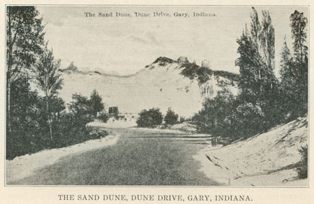
East of Gary the accumulation has been added to the Tolleston Beach and by the winds piled high into great dunes. When one now speaks of the dunes he usually means the great dunes along the lake shore between Gary and Michigan City. This dune belt is from one-half to one and a half miles wide and the dunes are from 50 to 190 feet high.
The first ridge along the water’s edge extends from the Gary Steel Mills in an almost unbroken line to the Michigan State line, and beyond. Back of the first ridge the ridges vary in direction and enclose innumerable little valleys, which are from 10 to 50 feet above the level of the
604
lake and contain from a few square rods to more than one hundred acres in area.
The dunes are, with a few exceptions, covered with a great variety of trees, shrubs, vines, ferns, reeds, rushes, grasses, etc., and the little lakes, ponds and marshy places, which they many times enclose, add another great variety of vegetation.
Here many plants are found that are found nowhere else in Indiana. Here, as nowhere else, plants from the distant north grow side by side with plants from the distant south.
The current that comes down along the western coast of Lake Michigan washes away the western shore and carries the sand along to where the current strikes the southern shore where it and the other sand washed from the lake are cast upon the shore, dried by the wind and the sun and blown by the winds into dunes of every shape, form and size.
Here along the southern shore of Lake Michigan are the greatest dunes anywhere to be found along the shores of the great lakes. Mount Tom, located immediately upon the water’s edge, is 190 feet high and covers more than one hundred acres. It is almost due north of Porter and Chesterton, in latitude forty-one degrees and forty minutes north, and longitude seventy-eight degrees and three minutes west. Near it are many other dunes almost equal in height and many of them much greater in area.
At many places along the lake, dunes are now being made, sometimes growing many feet in height and greatly in area; in a year covering up great growing trees, and at other places dunes are being blown away, uncovering trees that have been buried, perhaps, for centuries. These great bare tree trunks are now being resurrected, but not to life; they stand up now, gaunt and black, silent witnesses of their own murder.
Always the fight is between the sand and the trees, bushes, shrubbery and other vegetation. It is almost an even fight; in many places the vegetation has conquered at least for a while, but in others the sand has mastered.
The formation of the dunes is easily understood. As the wind, which is carrying or driving along the sand, meets an obstruction, such as a tree, a shrub, a bunch of “sand” or “dune grass” that flourishes upon the highest and driest dune, or a clump of “sand” or “dune willows” that grow everywhere on the sand regardless of soil or moisture—anything that will impede the wind, its current is interrupted, and in the quieter area in the lee of the obstruction, some of the sand is dropped. A little pile or drift of sand accumulating in such a place is the beginning of a dune. The “dune grass” and the “dune willows” grow and go up with
605
the dune. The growing dune itself becomes an obstruction against and beyond which more sand lodges, and thus the dune grows until the height of the dune itself, or some other cause, stops its growth.
When the dune stops growing, it is soon covered over with a great variety of “dune vegetation,” which preserves it for a while at least, but eventually a place made bare by the uprooting of a tree, a snow slide, the burning away of the great vegetation or the burrowing of some wild animal, may start a “blowout,” which may increase until the whole dune is destroyed; but many times the trees, felled by the sand being blown away from their roots, form a new lodging place for other sand and the “blowout” may in time be filled up and covered anew with vegetation.
Destruction and construction usually go hand in hand. The wind takes up and drives along the sand, not only from the beach, but from the surface of bare dunes; it is carried or rolled up over the crest to be dropped on the lee-ward side, where it is piled just as steep as its nature will permit. This movement is known as the migration of the dunes. In this migration, dunes cover up forests, fill up rivers, ponds, and small lakes and invade low-lands and fields.
Thus we see that the dunes are not fixed, but moving, slowly, silently, irresistibly, mysteriously.
“The dunes, the dunes; they drift and flow
Like billowy waves of ocean wild;
No rest their changing contours know,
Heap upon heaps the winds have piled.”
See the shining shifting sand, spotless perhaps; not a twig or a pebble nor a mark of any kind on it, except the little ripples on its surface, like those on the sea shore or the shore of the great lake at its base, left by the receding waves.
Near the base of this mountain of sand, piled steep and high, the grass and shrubbery are becoming covered; a little further up, the trees stand half submerged; still nearer the top you can see only the very tops of great trees; soon they will be literally buried alive and die from suffocation.
Back to windward, trees that have been buried, perhaps, for ages, are being uncovered, leaving their denuded trunks standing like ghostly monuments of an arboreal graveyard.
To the geologist the dunes are very interesting.
To the botanist they are unique.
To the naturalist they are a wonderful field of study.
To the artist and poet they are an inspiration.
606
SANDLAND.
By GEO. E. BOWEN.
Sandland at twilight,
All hushed in brooding gray —
A place to find your heart again
And cast your cares away.
Duneland at sunrise,
Life’s glory risen new —
The arms of freedom flinging wide
The gates your dream saw thru.
Sandland in starlight —
The night-song’s voice is dear,
And folds the peace you thought of God
Where held your heart its fear.
Duneland at noon time —
What sorry stuff is gold,
That royal pride and miser greed in foolish passion hold.
Sandland in shadow —
Or shining in the sun —
What care you for the fame of men
Or what their-wars have won?
For Duneland is dearest
Because no place is there
For echoes of the battle field
Or scars its victims wear.
Give me for a solace
The shelter of the dunes,
The songs that die in city streets,
Again are laughing tunes,
My dream of mighty temples
And victories of trade.
Ah! Foolish dreams, for the truth
Is Duneland’s wonder made.
I may go back to trading,
To kingscraft, law or art —
But here, beside this castled strand
I leave my honest heart.
I need it not where commerce grinds
The souls of men to dust —
So, leave it where there is no fear,
To sing the songs it must.
607
The beach along the shore of Lake Michigan near the dunes is four or five feet above the ordinary level of the water and is from fifty to one hundred yards wide, and, like the beach of old "Lake Chicago,” is composed of sand and gravel, mostly sand.
At the shore line the sand is from eight to twelve feet deep and extends out to where the water is twenty-five or thirty feet deep. Beyond this depth and at some places not so deep, clay banks may be found, evidently the remains of moraine deposits left by the retreating glaciers. Around and between these clay deposits are usually sand pockets, or bars, not yet washed ashore.
The water along the shore near the Dunes is quite shallow for several hundred feet from the shore and affords many miles of beautiful bathing beaches.
THE FLORA OF THE DUNES.
By George Pinneo, Botanist and Physical Director of the Gary Y. M. C. A.
(See Note Below.)
“The greatest flora of the United States is the dune region of our immediate vicinity.” This statement was made to the writer soon after coming to Gary. He did not believe an untruth was being told him but unconsciously classed it with the statement that "Mars is inhabited” and other abstruse and scientific facts. With all the barrenness of the sandy areas and the consequent lack of plant life, it was a very apparent mistake. The statement is true, however and holds good not only for varieties but for number and unusual beauty as well.
In most localities one is delighted to find specimens of plant life but in this vicinity the hillsides are purple with violets and lupine. There are the beautiful fringed gentians and hundreds of orchids. The distribution over the seasons is equally remarkable but at all times, from the coming of the trailing arbutus early in May until the passing of the gentian in October, one’s search is always rewarded with some of nature’s most beautiful productions.
There is a story that Jacob Bailey, the first white settler in this region and a great friend of the Indians, is responsible for many of the plants seemingly out of their natural habitat. The story goes that because of many kindnesses, the Indians coming from northern points brought unusually beautiful flowers as presents to him, and either they or other Indians coming from the opposite direction did the same. It is very interesting as a legend but can in no way account for the varieties.
Note: This story of the Flora of the Dunes was written and prepared by Mr. Pinneo for publication in 1917 when the movement was underway to reserve the Dune Region for a National Park.
608
There seems to be two things entering largely into the question. One is that we find many plants in this region which at this point reach their northern limit. Of these may be mentioned the tulip tree, the sassafrass, the sour gum and the paw paw. We, can only account for the distribution of northern varieties by their having been carried very slowly in the debris of the glaciers moving south, and being accomodated for a great length of time in the left-over glacial fragments of ice so that they are able to establish themselves. The last tree one finds as they reach the timberline approaching the northpole is the jack pine. And strange as it may seem we are fortunate in having this same jack pine in our vicinity.
As one proceeds still further north the last representative of plant life to withstand the ravages of the arctic weather is the lichen moss. Here again we are surprised and delighted to find this same lichen moss. Between these two extremes of the far north and the semi-tropical American, we find a splendid number of both plant and tree life in great variety.
The dwarf and the giant of several varieties are found here. We find the beautiful berry, so small that it may be stepped over unnoticed, the smallest member of the dogwood family, and the flowering dogwood trees which may be 50 feet high and entirely covered with beautiful flowers as large as four inches in diameter. The aromatic sumac sometimes only a few inches high, takes its place as the smallest member of that interesting family, while the stag horn is the giant with specimens of trees eight inches in diameter and 50 feet high.
CARNIVOROUS PLANTS.
Carnivorous plants are classed as unusual and almost miraculous. To one’s mind they exist largely in stories or at least only in the tropics where all nature seems to have gone awry. But here in our section we are fortunate in having two plants classed as carnivorous. One is strictly so and the other one only in part. The sun dewes, of which we have two, are classed as strictly carnivorous with leaves covered with small glutinous balls of liquid which reflect the sunlight like the honey dew on leaves of other plants. The insects alight only to find that they are held fast by the sticky mass. The tiny leaf slowly enfolds the victims and it is slowly absorbed, after which the leaf opens itself again to repeat the operation.
One of the most interesting of all plants is one known as the pitcher plant. Its leaves are cylindrical and often holds as much as a half pint of water. Insects seeking water find themselves unable to crawl out of the tube because of the recurved hairs which make it very easy to get into
609
the leaf but impossible to get out. The insects falling into the water disintegrate and the substance is absorbed by the plant.
The writer, last summer, found a small lizard about one inch in length held captive there. Although liberated he was apparently in no danger, since there was always sufficient insects for food for him and in time he would, of course, have been able to climb out and escape because of his length.
LILIES.
Flowers, like politics, make strange bedfellows. The onion is a lily, and its flowers perfect in shape for one of its family and quite pretty. The cucumber root, another member of the family, is very pretty and interesting. Both the white and yellow dogtooth violets are found in splendid numbers and early in the season produce the most beautiful flowers one finds. The real beauty of the family is contained in two varieties, however, the wood and Turk’s cap lily. The wood or red lily, the earlier of the two, grows by the thousand. The flowers of this variety stand upright, are a bright red in color and unsurpassed for beauty by any of the cultivated varieties. The Turk’s cap lily with drooping heads, long and beautifully colored pistils and stamens and recurved petals, are unusual in size and often bear as many as a dozen flowers on one stalk.
CACTUS.
There is no plant that seems more unusual or out of place than our cactus. It is found growing on the bare sand and apparently thriving. The surprise of finding the plant is no greater than that of finding large and beautiful yellow flowers upon it.
THE HEATH FAMILY.
The Heath family is one of the interesting families with the Laurel perhaps the best known. Trailing arbutus is a member of the family and is classed by many as one of the most, if not the most, attractive of wild flowers. This delightful flower comes early in the season and has an unusual fragrance.
The wintergreen with its beautiful red and delightfully flavored berries is another member of this family. The bear berry of the same family is not very attractive, but is found in great profusion on many of our hills.
From this large family comes one of the finest of our wild berries, the blue berry. Here again there is a great difference, the smaller one of the family being only a few inches in height. The bush variety is so tall that one must bend over the bushes if the berries on the topmost branches are to be secured. The cranberry is also a Heath plant and
610
still grows in this locality. The size of the berries is easily the equal of those put on the market. The contrast of the beautiful red berries and the green moss, which supports them, is the most beautiful of the wild fruit.
The night shade family is well represented in this region in the wild flowers of several different varieties. Although many types of this family are quite poisonous, our Irish potato is one of the exceptions, forming the one most staple, vegetable diet for mankind.
The rose family is well represented with many different varieties of roses as we know, and also a large number of different varieties of strawberries and blackberries which belong to the same family.
The violet family in our region is unusual both as regards varieties and numbers. More than 12 varieties ranging in size from the small white violet, which is two or three inches high, to the Canadian violet, which is more than one foot in height.
The most valuable commercially and the most sought for wild flower the United States had produced is the ginseng. The powders from this plant have ranged in prices all the way from $4.00 to $28.00 per pound and there is always ready sale for the berries. For more than 50 years the woods in this region have been thoroughly hunted by professionals and by residents who knew the value of the same. Yet, notwithstanding all this persecution, the writer found a large stalk of ginseng growing in this vicinity last fall. No doubt there is still a small amount left in various places. Great care should be exercised that it be allowed to grow, that it may not be entirely exterminated. Wild ginger is another one of the unusual plants found in this vicinity.
ORCHIDS.
The orchids are the aristocracy of plant life. This is true both of the commercial as well as the wild varieties. There seems to be a charm even about the name itself which indicates the unusual. Ordinarily one thinks of orchids as those growing parasitic on trees and taking their nourishment from the atmosphere by means of air roots. Those which live in this way are able to exist only in the tropical climates. In one case, that of our showy orchid, we have one specimen which is parasitic on the roots of other plants.
The orchid family is highly specialized. One of the petals forms either a sach, a pouch or spur as the case may be in different varieties. The placing of the nectar at a most inaccessible point, causes cross fertilization of the flowers by various insects. In the case of the lady’s slipper the fertilization is done by bees. In the case of those with the spur the fertilization is done by moths and butterflies who are able to secure the nectar because of the length of their tongues. The spur of
611
the purple fringed orchid and the yellow fringed orchid is an inch in length and the butterfly in order to secure the nectar must have a tongue one and one-half inches long.
The writer has classified 27 different orchids in this vicinity. Of these quite a number are small and inconspicuous. The following, however, compare favorably with most of the beautiful, cultivated flowers, in both form, color and in many instances fragrance.
The showy orchid, which is a spike of beautiful flowers, is both fragrant and beautiful and is found early in the spring.
The colopologon or grass pink is found in great numbers in some places. It is a beautiful orchid, pink in color and numbers three or four flowers in a single spike. This flower is without fragrance and is the only one of the species which is self fertilizing. The lip bears a number of stamens. As the flowers mature and is moved by the breeze, the lip falls and comes in contact with the pistil which is diametrically opposed to the lip. The large purple fringed, the small, purple fringed and the yellow fringed and the white fringed orchid are of the same type as those growing on the spike and develop in the midsummer. The lady slipper orchids are very rare and one would always consider himself very fortunate in finding specimens of the same, but in our locality they grow, literally by the hundreds. All varieties found in the United States, with the exception of two are found here.
The Indian pink is one of the rarest in our locality, and has been found in only one place in this region. Because of the fact that orchids are highly specialized in regard to fertilization they must depend very largely on their roots for reproduction. For this reason great care should be taken not to in any way injure the roots if one plucks the flowers.
It is impossible to give, in a paper like this, the large number of flowers one may secure in our locality. There are two things, however, in which we are especially interested. One is that a large number of people will interest themselves in the flora of our region and the other is that they will also interest themselves in the preservation. The number of our plants are remarkable and in many cases may not be equalled anywhere in the world. Ruthless destruction, however, by mankind has destroyed our wild birds and our forests and it may easily do the same with the flowers which we have left. It is to be hoped that those interested and appreciative of the beauties of nature will do everything* in their power to preserve for posterity a large number of the beautiful things with which nature has endowed our sand dune region and that in the years to come we may have a wonderful national park on the south shore of Lake Michigan which will contain not only the dunes and trees but a large number of our beautiful wild flowers, blooming as the white man found them early in the last century.
612
THE DUNES PARK.
Who first conceived the idea or openly suggested to set aside a large area of the Dune lands in Northwestern Indiana for use as a park is a matter of conjecture but it is known that during the year 1,912 members of the Prairie Club of Chicago openly advocated that the Dune lands be made into a national or state park. The Prairie Club made week-end tours by walking into interesting territory in the vicinity of Chicago — the Dunes being frequently visited and some of the members erected a club house on the bluffs overlooking the lake and confined their walking activities to exploration of the thousands of acres included in the Duneland area. John O. Bowers, historian of Gary and who owned some land in the Dune area, became greatly interested in the park idea after a conversation with Mr. Junius Daniels, a member of the Prairie Club and who for years occupied a cabin on Mr. Bowers’ property. Mr. Bowers secured some additional land especially desirable for park purposes and with others began to agitate the park project, but the early sponsers were mainly residents of Chicago to whom the Dunelands had become familiar territory through frequent visits. One of the first if not the first public expression in favor of a park was from Jens Jensen of Chicago, President of the “Friends of Our Native Landscape,” who in a very interesting article on the beauty of the Dunes in the Chicago Daily News of July 6, 1914, openly advocated the park idea and stated he would like to see established there an institute for the biological, botanical and geological classes of the Chicago schools and the universities. His plan was backed by the “Friends of Our Native Landscape,” by the Prairie Club of Chicago and the Chicago Geographic Society, and Chicago may be safely credited for giving the first impetus to the park idea and in a large measure the organizations above mentioned, later assisted by other Chicago citizens, are responsible for the growth in public sentiment which eventually made possible the establishment of the park. As early as 1914 or 1915, Rev. Eric I. Lindh, Pastor of the First Congregational Church of Gary, was active in agitating the park idea and contributed several articles to the Gary Tribune, enthusiastically supporting it. Other local citizens became interested and on May 1, 1916, in a letter to Mr. Richard Lieber of the Conservation Commission, Mrs. John O. Bowers for the local Pottawatomie chapter of the D. A. R. suggested that “a demand would likely be made for the segregation of a typical section of the Dunes in the northern part of the state” and later Mr. Lieber became very much interested in the movement. Stoughten Cooley of Chicago in a strong and vigorous article appearing in the Chicago Herald of May 1, 1916, favored the purchase and segregation of some 5,000 or 6,000 acres in the Duneland for a public park while the same might be obtained
613
in its primitive condition and this article was copied and printed by the Gary Evening Post on the same date with an editorial favoring the preservation of the remaining lake front for the state. That the idea was becoming favored widely is shown by the action of the Conservation Council of ten outdoor organizations of Chicago who, in response to Mr. Cooley’s article in the Chicago Herald, met and appointed a committee of seven to interest the Indiana Legislature in the purchase of a portion of the Duneland for a park; to raise money by popular subscription, and to enlist the aid of wealthy and philanthropic individuals to save said land from commercial encroachment. The committee consisted of Everett L. Millard, of the Municipal Art League; Miss Catherine
Mitchell of the Wild Flower Preservation Society; Dr. D. F. Roper and T. W. Allinson of the Prairie Club; Miss Zonia Baber of the Chicago Geographical Society; Dr. Henry C. Cowles of the University of Chicago; Miss Lena N. McCauley of the Chicago Horticultural Society; and Eames McVeigh who was asked to interview Judge Elbert H. Gary on the proposed conservation project. On May 15, 1916, the Pottawatomie Chapter of the Daughters of the American Revolution at Gary passed resolutions favoring a Dunes park which were forwarded to the State Park Memorial Committee and this action was probably the first definite step taken by any organization in Indiana for the preservation of a portion of the Dune country for a park. An illustrated sketch by Earl Reed entitled “The Dune Country” published about this time attracted some
614
attention and the Gary, Hammond and Michigan City newspapers were active in arousing favorable sentiment but the Indianapolis newspapers did not disclose much interest in the project. To stimulate local interest the Pottawatomie Club, Daughters of the American Revolution, held its annual picnic in 1916 at the club house of the Prairie Club situated on the bluffs overlooking Lake Michigan, a short distance east of Mount Tom. A large number of invited guests were in attendance and it being early in June nature was decked in her gayest spring gown. It was the first introduction of a large body of Indiana residents to this primitive enchanting region and they were delighted beyond measure with the beauties and attractions of the Duneland. On July 16, 1916, pursuant to a general call issued by lovers of the Dunes a large meeting was held in a tent at the mouth of Fort Creek now known as Waverly Beach. The purpose of the meeting was the creation of an organization whose purpose should be to take steps to preserve a typical section of the adjacent territory as a park and it took three special trains to bring the Chicago contingent. Armanis F. Knotts, one of the active promoters of the meeting, was chosen chairman and Thomas H. Cannon of Gary, secretary. Addresses were made by Jens Jensen, Superintendent of the Chicago Park System; Miss Catherine Mitchell, of the Wild Flower Preservation Society; Everett L. Millard, of the Municipal Art League; T. W. Allinson; George M. Pinneo, athletic director of the Gary Y. M. C. A. and local botanist; Caroline Mcllvaine, of the Chicago Historical Society; Rev. Eric I. Lindh, pastor of the First Congregational Church of Gary; A. F. Knotts of Gary, and several others. A letter from Stephen T. Mather, Assistant Secretary of the Interior, and superintendent of National Park Service, favoring the park project, was read by Jens Jensen. Many outdoor organizations were represented. A resolution was passed empowering the Chairman, Mr. Knotts, to name a committee of fifteen, composed of residents of the states of Illinois, Indiana and Michigan, to incorporate a national organization, to be known as the National Dunes Park Association, and to prepare by-laws for such organization, and to report at a meeting to be held July 30th, 1916, at 2 o’clock P. M., at the Gary Public Library. Among those present at this first meeting from local towns and cities were: Hon. Harry B. Tuthill, and Mr. Joe Redpath, of Michigan City; Herbert E. Graham, John O. Bowers, Carl A. Dennewitz, Alfred Jones, and Thomas Cannon, of Gary; James Blackman. J. G. Johnson, Edward Morgan and Charles Jeffries, of Chesterton and Porter, and Dr. Charles A. Stolz of South Bend. An American flag was raised on the top of the highest dune, and doubtless, for the first time in his career, old Mount Tom cooled his brow in the shifting shadows of the Stars and Stripes while he sat bathing his feet in the rippling waves of this inland sea. Pursuant to an adjournment of the above meet-
615
ing, the friends of the park project, together with the committee appointed by President Knotts, met in the library building, in the city of Gary, on July 30th, 1916. At the adjourned meeting held at the public* library, A. F. Knotts was elected president, Mrs. Frank J. Sheehan, Secretary; Professor Lee F. Bennett of Valparaiso University, Treasurer; John O. Bowers, Thomas H. Cannon and George M. Pinneo, Directors for Lake County. Among those present at the meeting were Hon. Harry B. Tuthill, Martin Krueger and George O. Redpath of Michigan City, who not only had been previously active in promoting the park, but rendered every aid in the later movements which brought realization of the project. On September 7th following, Hon. Thomas Taggart, Senator from Indiana, submitted a resolution in the United States Senate which directed the Secretary of the Interior to investigate and report to Congress the advisability of securing by purchase or otherwise all that portion of the counties of Lake, LaPorte and Porter in the State of Indiana bordering upon Lake Michigan, commonly known as the sand dunes, with a view of creating said land into a national park and that the Secretary should also report on the cost of acquiring such lands and the probable expense of maintaining them as part of the national park system. Pursuit to this resolution a meeting was called by Stephen T. Mather, Assistant Secretary of the Interior in the Federal Building in Chicago on November 30, 1916. About 400 nature-lovers and scientists attended the meeting. Prominent in attendance and who made addresses at the meeting were Abraham Flexner, president of the New York City Board of Education; Lorado Taft, the sculptor; Earl H. Reed, author and sketch artist; Dr. Graham Taylor, socialogist; Professor Roland H. Salisbury, botanist, University of Chicago; Professor T. C. Chamberlain, geologist, of the University of Chicago; Professor Henry C. Cowles, of the University of Chicago; Miss Harriet Monroe, the poetess; Jens Jensen, landscape architect; LaVerne W. Noyes; Will J. Davis; Caroline M. Ilvaine, of the Chicago Historical Society; George A. Brennan; Dr. Otis Caldwell, President of the Chicago Historical Society; Julius Rosenwald; Zonia Baber, botanical instructor of the University of Chicago; J. W. O’Leary, President of the Chicago Association of Commerce; Lena M. McCauley and O. M. Shantz. Among those in attendance from Northern Indiana were the following: Armanis F. Knotts, Captain H, S. Norton, John O. Bowers, Mrs. Frank J. Sheehan, Mayor R. O. Johnson, and Thomas H. Cannon of Gary; A. J. Smith, of Hobart; A. J. Bqwser and J. G. Morgan, pioneer settler eighty years old, of Chesterton; Richard C. Lieber, of Indianapolis; Jesse E. Wilson, of Hammond; George O. Redpath, of Michigan City; Professor Lee F. Bennett, of Valparaiso. All of the addresses and utterances were in favor of the project and a pamphlet containing the proceedings of the meeting was later published by
616
the general government. On the day following the meeting a large delegation headed by Mr. Mather and Mr. Dobb, investigator for the Department, visited Waverly Beach and made a general survey of a large section of the Duneland. About this time Dr. Clifford Mitchell advocated a national park in the Dunes in an article in Clean Living, a Chicago publication, which attracted considerable attention. Mrs. Sheehan, Secretary of the National Dunes Park Association and who had been interested in the project for some time prior to her election as secretary, in an address at Richmond, Indiana, on October 24, 1916, made an eloquent plea for the preservation of the Dunelands and the establishment of a public park and her active interest from this time forward never faltered until final action was taken by the Indiana Legislature and the park established. Uncertain as to what action Congress would take on the park project, a bill was introduced in the Indiana Legislature in the session of January and February, 1917, for the incorporation of associations with power to acquire by purchase, gift, donation or other means, real and personal property for public or forest preserve purposes or both, and empowering the corporation to improve such lands acquired and transfer the same to any municipality, county or the State of Indiana for a public park or forest preserve. The bill further provided that such associations should be organized to be operated without profit. The bill met with violent opposition by Porter County citizens and was defeated. The Chamber of Commerce of Valparaiso and the Porter County press were particularly active in opposition to the bill taking the ground that it would prevent the industrial development of the Porter county section of the lake shore although they expressed no hostility against the reservation of a part of the Duneland bordering on the shore. The sincerity of the promoters of the bill could not be questioned as they realized that continued agitation would cause the price of land in the Dunes territory to rise rapidly but if a corporation could be organized speedily and bring suit for the condemnation of land a large park could be obtained at a modest price per acre. It was further thought that funds could be raised by donations or gifts and when the lands were acquired they might be deeded to the state, county or town, if any, that seemed to promise the best results. Notwithstanding the charge made by many citizens of Porter county that the United States Steel Corporation were aiding the park project to prevent further industrial development on the Porter County lake shore, it was not generally believed nor was there the slightest known evidence existing that the United States Steel Corporation or its officials were favoring the project through any selfish motives. On February 28, 1917, Franklin K. Lane, Secretary of the Interior, by his assistant, Stephen T. Mather, filed his report in response to the above mentioned resolution introduced in the United States Senate by the Hon.
617
Thomas Taggart, of Indiana. Such report recommended the purchase of approximately fifteen square miles of dune land along Lake Michigan in Porter County for the establishment of a national park, at an estimated cost of a sum between one million eight hundred thousand dollars ($1,800,000.00) and two million six hundred thousand dollars ($2,600,000.00), thus being about two hundred dollars ($200.00) per acre. This report was afterwards printed as a public document of the Department of the Interior, and was distributed. The declaration of war by Congress against Germany on April 6, 1917, put further action for the park by that body far into the future and the efforts of the citizens who favored the park became now concentrated on its purchase by the State of Indiana. To further promote the project, a historical pageant was held on June 3, 1917, under the auspices of the Dunes Pageant Association, Friends of Our Native Landscape, the Chicago Historical Society and the Audobon Society, the Municipal Art League, the Chicago Public Schools, the Art Institute, and the Illinois Federation of Women’s Clubs. On April 10, 1917, the National Dunes Park Association was incorporated in Indiana and the same officials were elected who had been serving before the organization was incorporated. The Dunes Pageant Association, promoted by the Prairie Club, was an incorporated body under the laws of Illinois and included among the incorporators were: Jane Addams, John D. Shoup, Everett. L. Millard, Graham Taylor, Caroline Mcllvaine, Lorado Taft, Eames McVeagh, Charles E. Gunther, Earl Reed, James L. Houston, Dr. Otto Schmidt, all of Chicago. Among its trustees were Will J. Davis, Dr. Henry C. Cowles, Ethel M. Durfee, Caroline Mcllvaine, Thomas W. Allison, Eames McVeagh, all of Chicago, Mrs. Frank J. Sheehan, of Gary, and Professor Lee F. Bennett, of Valparaiso. The officers of the association were, James L. Houston, Jr., President, Ethel M. Durfee, Secretary, and Charles L. Hutchinson, Treasurer. The pageant author was Thomas Wood Stephens, and the pageant director was Donald Robertson, of Valparaiso. Among the subscribing patrons were the following: Samuel Insull, Cyrus McCormick, Stephen T. Mather, Assistant Secretary of the Interior; Everett L. Millard, Dr. Edward H. Ochsner, Potter Palmer, Jr., John Barton Fayne, Mrs. George M. Pullman, Julius Rosenwald, Silas H. Strawn, Louis Swift, Caroline Mcllvaine, Lorado Taft, Graham Taylor, Edward G. Uihline, Charles M. Wacker, Ralph Van Vechten, Charles B. Shedd, and Frank H. Tuthill. The program of the pageant and masque was composed of six episodes, as follows: (1) 1671-1675, the arrival of Father Marquette on his return from his mission to the Illini Indians. The characters were Pierre Marquette, Poreiret, Jacques, an Indian Chief, and a band of Indians, and the Prophet (Don Robertson); (2) 1681, scene — the coming of LaSalle. Characters, La Salle, in the name of the King of France, McMillan; Miami.
618
Chief Moangan; Iroquoise Chief; (3) 1779, the De Linctot scene. Characters, Lieutenant De Linctot, Commander of Little Fort, at the mouth of Fort Creek (place being now known as Waverly Beach), Hamelin; Indian guide; Lieutenant De Quindr, and Tom Brady, in a battle in the Revolutionary War, the only one fought in this region; Tom Brady in battle at Fort Creek; (4) 1780, the Spanish march from St. Louis to Fort St. Joseph. Characters: An Indian runner, and Payon; (5) 1804-12, Fort Dearborn scene. Characters. Lieutenant Sweringen leading troops of the United States Regulars by the Detroit-Chicago road, camping at Little Fort, John Kinzie, Mrs. Kinzie, Captain Heald, Mrs. Heald, Chandonnai, an Indian chief, and an Indian squaw; (6) 1934-36, the City West scene. Characters, Joseph Bailly, Madame Bailly, the daughters of Monsieur and Madame Bailly, Jean a Catholic priest, Mr. Morse, Mr. Jacob Bigelow, Mr. Leverett Bradley. Mr. Hervey Ball, Indian servants, Sally; Senator Daniel Webster, oi the River and Harbor Committee, stopping on his way from Chicago to Michigan City, makes a speech at City West. The largest gathering of citizens in northern Indiana attended the great spectacle and the great natural amphitheatre just West of Waverly Beach was literally filled with visitors who had come from Chicago and other cities and places in Illinois, also from the Calumet Region, Michigan City, South Bend, and points in Michigan and the entire surrounding country. Such a spectacle had never before been witnessed in this region. Some newspaper reporters estimated the crowds at forty thousand. The setting was fine, the program excellent and the acting superb. Those who were present certainly will never forget that wonderful spectacle on that wonderful day and caused the “Dunes” to become the Mecca for thousands and thousands of the lovers of the great out-doors on week ends during all seasons of the year, not even barring winter. So great was the attendance that although the parking grounds held 5,000 cars, the occupants of twice this number were unable to get within sight of the grounds. The result of the pageant was to still further increase interest in the establishment of the park and prominent citizens of Chicago and many eastern cities wrote articles in its favor. In order that the friends of the park living in Gary might have a local organization through which they might concentrate in their efforts for the promotion of the project, a Gary chapter of the National Dunes Park Association was organized of which Mr. Charles Davidson was elected President and Mrs. Frank J. Sheehan, Secretary. Doth parent organizations and the local chapter kept on working under adverse circumstances for the attainment of the ultimate end a park either state or national. Mrs. Sheehan was particularly active in causing women’s clubs throughout the state to become interested in the project. At the expiration of Mr. Knott’s term of
619
office William P. Gleason, Superintendent of the Illinois Steel Company plant, was elected President of the National Dunes Park Association and did much toward the ultimate acquisition of the park. Land in and near the proposed park area had risen in value through the long agitation and some of it was being sold at prohibitive prices and as the opposition from Porter County residents had somewhat lessened it was decided to concentrate every effort on the passage of a bill for the park during the session of 1923. A compromise bill generally satisfactory to citizens in Lake, La Porte and Porter Counties, was agreed upon and submitted in the state senate by Hon. William Brown, Senator for Porter County, and in the House of Representatives by Hon. W. A. Hill of Hammond, Joint Representative of Lake and Porter Counties. The bill contained a provision for a levy for the year 1923 and annually thereafter for a period of seven succeeding years, of the sum of two mills on each $100 of taxable property in the state for the purpose of raising a fund for the purchase of a tract of land three miles in extent along the southerly shore of Lake Michigan, to include a typical section of the Dunes and the total area of which should not exceed 2,000 acres. The lands to be acquired were to be purchased by members of the Conservation Commission together with one member of the State Senate and one member of the House of Representatives both to be appointed by the Governor, the Commission and these two members to constitute a Purchasing Board. The right of condemnation for park purposes and the right to accept gifts, bequests and donations were included in the bill. Even with the hostility of Porter County citizens largely removed the bill was about to be rejected when its friends came to the rescue and brought about its passage. In this connection, the efforts of Mrs. Frank J. Sheehan deserves special mention as she induced former United States Senator Thomas Taggart and many other leading citizens throughout the state and representatives of women’s clubs to interview members of the legislature who finally saw the light and the bill became a law. As no funds were available until a levy was made and a tax paid and as land prices were advancing as rapidly as the tax was accumulating, friends of the park solicited, importuned and interviewed heads of large industrial and commercial institutions, some of whom had special interests in the general welfare of the Calumet Region, for financial aid. Judge Elbert H. Gary led the donations by a generous gift of $250,000; Julius Rosenwald of Sears-Roebuck Company, Chicago, followed with a donation less in magnitude than that of Judge Gary but aggregating many thousand dollars and the money for the first purchase of lands thus became available. In addition to the regular Conservation Commission the Governor had appointed Senator James V. Nejdl and Representative T. A. Gotschalk, of Berne, as members of the Purchasing Board. The site selected
620
was a typical section of Duneland, with three miles of lake frontage lying directly north of Chesterton. During the period between 1913 and 1925 prices of land had risen to such a high point that the question of making a substantial initial purchase of the desired amount of acreage at the proper price was a problem. William P. Gleason and Ingwald Moe, active friends of the park project, were interested and active in the establishment of a modest price for the initial purchase as a precedent for further purchases and secured from Mr. John O. Bowers, another active friend of the park, 120 acres of the most attractive lands at $300 per acre which was about half the price generally asked for lands included within the limits of the proposed park. The delivery of the deed by Mr. Bowers to the Conservation Committee and Purchasing Board was an occasion for an appropriate ceremony. Governor Edward Jack- son and his family were spending a vacation at Waverly Beach within the proposed limits of the park and on the morning of September 2, 1925, a group composed of Governor Jackson, William P. Gleason, Superintendent of the Illinois Steel Company plant, Hon. William Guthrie, Chairman of the Conservation Commission; Col. Everett L. Gardner of Monticello and Hon. T. A. Gottschalk of the Purchasing Board, Mr. Ingwald Moe and Mr. John O. Bowers, proceeded from the Governor’s summer residence to the top of a towering dune called Tremont and having raised the State flag on its summit; the deed to the property which included this dune was delivered by Mr. Bowers to the Governor and in turn a check for the price was delivered to Mr. Bowers. In honor of Governor Jackson the name of the peak was changed to Mount Jackson as Governor Jackson rendered valuable and efficient service in hastening the attainment of the park. Since that time several other tracts have been purchased and approximately 2,000 acres have now been secured by the state. Thus after twelve years of arduous efforts, apparently hopeless at times, the park became a reality. It would take pages to give the list of all of the outstanding citizens in the Calumet District and the many non-residents who rendered valuable aid and assistance in the realization of the project. It is only proper however to especially mention the services of W. P. Gleason, whose attitude and friendship toward the park was unquestionably an important part in the decision of Judge Gary to make his generous gift and who contributed valuable service in many directions and also Mrs. Frank J. Sheehan whose years of effort in arousing public sentiment in favor of the park and whose activities in the legislative session of 1923 were such potent influences in the establishment of the park. Many other citizens who contributed greatly to the realization of the park are: Everett L. Millard, Dr. Henry C. Cowles, Miss Catharine Mitchell and Miss Caroline Mcllvaine of Chicago; George M. Pinneo, whose story of the Flora of the Dunes is a part
621
of this chapter; Charles T. Millspaugh, curator, department of botany, Field Columbian Museum of Natural History; Sara P. Kinsey, Valparaiso University; Mrs. John O. Bowers of Gary; Ingwald Moe of Gary; W. S. Blatchley, Indiana State geologist; George A. Brennan, Chicago School Principal; Mary K. Sherman, Conservation Department, General Federation of Women’s Clubs; Governor Lowden of Illinois; former Governor James P. Goodrich; Governor McCray, who at the solicitation of W. P. Gleason of Gary, recommended the park project in his inaugural message and used his influence during the legislative session of 1923 in favor of the act to create the park and who signed the measure after its passage; organized Indiana groups who gave active support including the Indiana Federation of Clubs, Daughters of the American Revolution, Rotary, Kiwanis, Elks, Masons, Federation of Labor and Lions Clubs. The press of Lake and LaPorte Counties rendered the most valuable aid and assistance in creating public sentiment in favor of the park and special credit should be given to the Gary Post, the Gary Tribune and the later consolidated Gary-Post Tribune who with the Hammond Times and the Michigan City News were a potent influence in bringing to a successful conclusion the realization of the project.
NAVIGATION OF
HISTORY OF THE LAKE AND CALUMET REGION OF INDIANA
FOREWARD
AN APPRECIATION
CONTENTS
CHAPTER I - Geology and Topography
CHAPTER II - The Mound Builders
CHAPTER III - Days of Indian Occupancy
CHAPTER IV - Early Explorations
CHAPTER V - Border Warfare
CHAPTER VI - Lake and Calumet Region Becomes Part of United States
CHAPTER VII - After Wayne and Greenville - Tecumseh and the Prophet
CHAPTER VIII - Indian Peace
CHAPTER IX - Early Settlements and Pioneers - County Organization
CHAPTER X - Townships - Towns - Villages
CHAPTER XI - Pioneer Life
CHAPTER XII - The Lake Michigan Marshes
CHAPTER XIII - Agriculture and Livestock
CHAPTER XIV - Military Annals
CHAPTER XV - The Lake and Calumet Region in the World War
CHAPTER XVI - The Newspapers
CHAPTER XVII - The Medical Profession
CHAPTER XVIII - The Bench and Bar in the Lake and Calumet Region
CHAPTER XIX - Churches
CHAPTER XX - Schools
CHAPTER XXI - Libraries
CHAPTER XXII - Social Life
CHAPTER XXIII - The Dunes of Northwestern Indiana
CHAPTER XXIV - Banks and Banking
CHAPTER XXV - Transportation and Waterways
CHAPTER XXVI - Cities
CHAPTER XXVII - Industrial Development
CHAPTER XXVIII - Chambers of Commerce
Transcribed by Steven R. Shook, December 2022