Welcome Explore the genealogy and history of Porter County
 Situated in the northwestern portion of the State of Indiana,
Porter County is bounded on the north by Lake Michigan, on the east by
LaPorte
County, on the south by the Kankakee River and
Jasper County,
and on the west by
Lake County.
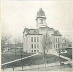
Established in January 28, 1836, Porter County's seat of government is located in the
City of
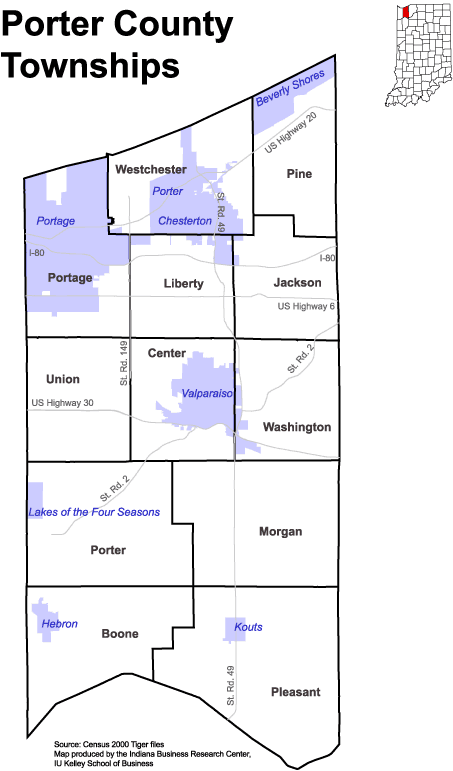
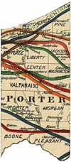
Valparaiso. The county consists of 12 townships [map]
covering a total area of 418.1 square miles.
Situated in the northwestern portion of the State of Indiana,
Porter County is bounded on the north by Lake Michigan, on the east by
LaPorte
County, on the south by the Kankakee River and
Jasper County,
and on the west by
Lake County.
Established in January 28, 1836, Porter County's seat of government is located in the
City of
Valparaiso. The county consists of 12 townships [map]
covering a total area of 418.1 square miles.
My name is
Steve Shook and I coordinate the Porter County website, which a component of
the
INGenWeb
Project, which in turn is a component of the
USGenWeb Project. If you would like to contribute information to this site, then
please send me an email. If you are interested in being an INGenWeb county
coordinator, then please contact the Indiana GenWeb Coordinator,
Lena Harper, or one of the Indiana GenWeb Assistant Coordinators,
Jim Cox or
Karen Zach.
The menu to the right provides a guide to a wealth of information concerning
Porter County genealogy and history organized by major topic area. Be sure to use
the search engine if you are seeking specific information.
A Brief History of Porter County As published in various histories of Porter County
This brief thumbnail sketch of Porter County's history has been assembled from a variety of histories published about the county. These sources can be found under the references link on the menu.
Pre-Columbian Era
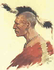 As with most of North America, the
early history of Porter County can be described as a very long history of Native
American occupation. Among the principal Native American villages located in
Porter County were Chiqua or Chipuaw, located about one mile east of Valparaiso,
and Tassinong, located north of present day Kouts. Nearby was the Native
American village of Wanatah, which is actually located in LaPorte County
near the east central border of Porter County.
As with most of North America, the
early history of Porter County can be described as a very long history of Native
American occupation. Among the principal Native American villages located in
Porter County were Chiqua or Chipuaw, located about one mile east of Valparaiso,
and Tassinong, located north of present day Kouts. Nearby was the Native
American village of Wanatah, which is actually located in LaPorte County
near the east central border of Porter County.
The territory covered by Porter County was frequently traveled by Sac Indians,
who lived to the west. The Sacs had two major trails crossing the county, called
the Sauk Trails, both of which were used by the early white settlers when
crossing the wilderness and homesteading in the region. One of these trails
forked into the area referred to as Twenty-mile Prairie, located on the west
central portion of the county. This prairie region
received its rather unique moniker not because of some sort of twenty-mile
dimension, rather it was located approximately 20 miles from the village of
Michigan City in LaPorte County. This branch of the Sauk Trail eventually crossed
through present day Washington Township; Indiana State Route 2 closely follows
this trail. The second Sauk Trail branch had a
course that essentially followed the northern boundary of the county near Lake
Michigan.
The French, British, and Spanish Era
Catholic priests
Claude Allouez and Claude Dablon are believed to have traversed Porter County in 1672.
It has been alleged that these two missionaries landed upon the
lake shore and traveled south to the Kankakee River, acquainting themselves with
the natives. In 1673, Father Jacques Marquette paddled eastward up the Kankakee
River to its source. Robert Cavelier Sieur de La Salle and about thirty men from
Canada, intending to discover the Mississippi River and its mouth in
1679, paddled down the Kankakee River to the Illinois River. Upon failing to
reach the mouth of the Mississippi, these explorers returned through Porter
County in 1680 via the Kankakee River. In 1681 La Salle returned, with a
much larger company of men, this time traveling along the shore of Lake
Michigan. By April of 1682, he and his men had discovered the mouth of the
Mississippi River and laid claim in the name of France to all the land that was
drained by that river, which included the land that today is known as Porter
County.
By 1759 the land
comprising Porter County was transferred to the British. Much effort was
expended by the British in skirmishes with the French and their Native American
allies over control of the fur trade in the region. Meanwhile, the Louisiana
Territory was secretly ceded to the Spanish by France by the Treaty of
Fontainebleau in 1762, and Spain decided in 1781 to attempt to take possession
of territory about the head of Lake Michigan. Accordingly, Spanish commander Don Eugenio Pierre arrived at
the lake shore from St. Louis in the winter of 1781 and claimed the land in the name of the
King of Spain without bloodshed or resistance. Spain's control over the land
that included Porter County was extremely brief, however, as England had signed
the Treaty of Paris with the United States on September 3, 1783, at the
conclusion of the Revolutionary War, which officially ceded control of land to the
Americans and set the western boundary of the United States at the Mississippi
River. Spain was soon forced to accept the claims of the new government of the
United States and the area comprising Porter County officially became part of
American territory.
Native American Removal and First White Settlement
In the St. Mary's Treaty of 1818,
several Native American tribes ceded land located in the central portion of
Indiana. The Delaware tribe agreed to removal west of the Mississippi River,
while the Miami and Pottawatomie tribes remained in Indiana after 1820. In
1826, these two tribes traded land that was needed for construction of the
Michigan Road and the Wabash and Erie Canal. The federal Indian Removal Act of
1830, however, allowed the Indiana General Assembly to remove the remaining
native inhabitants from the state. The Native Americans located in Porter County
were predominantly of the Pottawatomie tribe. In 1838, plans for removing the
Pottawatomies were in effect, but some of the tribal members objected to the
removal. Despite their objections, eight hundred Native Americans were escorted
to Kansas under an armed militia company in a disorganized and tragic march
known as the "Trail of Death."
In 1822, Joseph Bailly established a trading post near the Little Calumet River.
The area in which the post was located was later commonly referred to as
 Baillytown. The Pottawatomies could
often be found visiting Joseph Bailly and his family, trading beaver pelts for
such items as blankets, knives, metal hatchets, fabric, clothing, and alcohol. Bailly
would ship the beaver pelts to Mackinac, where they were consolidated with other
trader and trapper pelts and then shipped to Montreal and eventually to Europe.
Baillytown. The Pottawatomies could
often be found visiting Joseph Bailly and his family, trading beaver pelts for
such items as blankets, knives, metal hatchets, fabric, clothing, and alcohol. Bailly
would ship the beaver pelts to Mackinac, where they were consolidated with other
trader and trapper pelts and then shipped to Montreal and eventually to Europe.
Early Immigrant Settlement
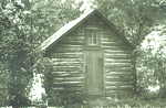
The only non-Native American resident
of Porter County, prior to 1833 was fur trader Joseph Bailly. In the spring of
1833, however, several immigrants arrived to homestead the land. The first to
arrive, sometime during the spring of 1833, were brothers William, Jesse, and Isaac
Morgan of Wayne County, Ohio. The Morgans were soon followed in June of 1833 by
Reason Bell, also of Wayne County, Ohio, George Cline, from Union County,
Indiana, Adam S. Campbell, emigrating from Chautauqua County, New York, and
Henry S. Adams, of Jefferson County, Ohio.
These immigrants made their way into Porter County into what is now Washington
Township, where they all, with the exception of Jesse Morgan, located on the northern portion of Morgan's Prairie.
Morgan's Prairie was a very suitable area to homestead since the ground was relatively dry and fertile and could be cultivated quickly
without the removal of forest. In addition, its location was ideal in that it
provided access to nearby forest land that could be used to procure heavy
timber. Jesse Morgan chose a plot of land in Section 6 of Westchester Township
to homestead.
A stage line through Porter County also began in 1833, traveling between Chicago
and Detroit, making three trips per week; Jesse Morgan's home is Westchester
Township was a stage house for the line. This stage line helped in opening up
Porter County to additional settlers.
In May of 1833, the site of Valparaiso (originally called Porterville and
Prattville) was
visited by Thomas A. E. Campbell, nephew of Adam S. Campbell, who at the age of
22 accompanied his uncle in migrating to Porter County. Thomas A. E. Campbell
chose a site for his homestead during this visit, later constructing his home there.
The first home in Valparaiso was constructed in early 1834 by J. P. Ballard.
Ballard's home was located in the valley of a stream that crosses Morgan
Avenue.
A government survey of the land in Porter County by Messrs. Polk and Burnside took place in the summer of 1834, and by
October of 1835 a substantial portion of the land in the county was offered for
sale by the General Land Office located in LaPorte. The sale of land rapidly
increased the volume of immigration to Porter County so that by 1836, the year
of the county's organization, a considerable population was resident in the
county.
In 1835, new-comers to Porter County included Putnam Robbins, David Hughart, E.
P. Cole, Hazard Sheffield, Allan B. James, Peter Ritter, G. W. Patton, the Baum
brothers, and David Oaks, among a few others.
Formal Organization of Porter County
In March of 1835, the county
commissioners of neighboring LaPorte County, who at that time had jurisdiction
over the land now comprised of Lake County and Porter County, ordered that all
the territory west of the LaPorte County line be laid off into townships. Three
townships were originally laid out: Waverly Township, bounded by Lake
Michigan to the north, LaPorte County line to the east, the south by the line
between Townships 35 and 36 north, and the west by the center of Range 6 west;
Morgan Township, bounded to the north by the southern boundary of Waverly Township,
east by the LaPorte County line, south by the Kankakee River, and west by the
center of Range 6 west; and Ross Township included all the territory west
of the line through the center of Range 6 west. Essentially, these three
townships were still part of LaPorte County.
 On January 28, 1836, the Indiana State Legislature passed an act creating
present day Porter County, effective February 1, 1836. The first Board of
Commissioners - John Sefford, Benjamin N. Spencer, and Noah Fouts - met
on April 12, 1836, and laid out the following initial townships: Boone, Center,
Jackson, Lake, Liberty, Pleasant, Portage, Washington, Waverly, and Union. Boundaries between these townships, as well as their names, changed a few times
during the early years of Porter County's existence until the present townships
were finally established.
On January 28, 1836, the Indiana State Legislature passed an act creating
present day Porter County, effective February 1, 1836. The first Board of
Commissioners - John Sefford, Benjamin N. Spencer, and Noah Fouts - met
on April 12, 1836, and laid out the following initial townships: Boone, Center,
Jackson, Lake, Liberty, Pleasant, Portage, Washington, Waverly, and Union. Boundaries between these townships, as well as their names, changed a few times
during the early years of Porter County's existence until the present townships
were finally established.
Today, the principal population centers in Porter County include Beverly Shores,
Burns Harbor, Chesterton, Dune Acres, Hebron, Kouts, Lakes of the Four Seasons,
The Pines, Portage, Porter, South Haven, Wheeler, and Valparaiso.
Menu
SITE SEARCH
LATEST UPDATES
-
Added
1984 township plat maps to the
Maps webpage.
[October 2, 2024] -
Added
Souvenir of College Hill, Valparaiso, Ind.
to the Miscellaneous
Items webpage. Booklet provides photograph concerning the
Northern Indiana Normal School & Business Institute.
[August 20, 2024] -
Added
Souvenir Valparaiso Ind. (1894) to the Miscellaneous
Items webpage.
[July 29, 2023] -
Added
Swedish Evangelical Lutheran Bethlehem Church in Word and Picture, Chesterton, Indiana, 1879-1920 (1920),
History of Salem Church (Presbyterian) in Porter County - North of Hebron, Indiana, 1844-1888 (1964), and
Weaving the Past into the Future: Bicentennial Handbook of Portage Township Schools (1976)
to the Miscellaneous
Items webpage.
[May 10, 2023]