USGS Topographical MapsPorter County topographical maps . . . .
US Geological Survey, Topographical Maps
The following topographical maps (7.5 minute series quadrangles) were prepared and published by the US Geological Survey. These maps cover the entire area of Porter County. Click the thumbnails below to access full size images. Note that several of these images are large files and may take considerable time to load on slower Internet connections, such as dialup.
 Ogden Dunes Quad |
 Dunes Acres Quad |
 MI City West Quad |
 Portage Quad |
 Chesterton Quad |
 Westville Quad |
 Palmer Quad |
 Valparaiso Quad |
 Wanatah Quad |
 Hebron Quad |
 Kouts Quad |
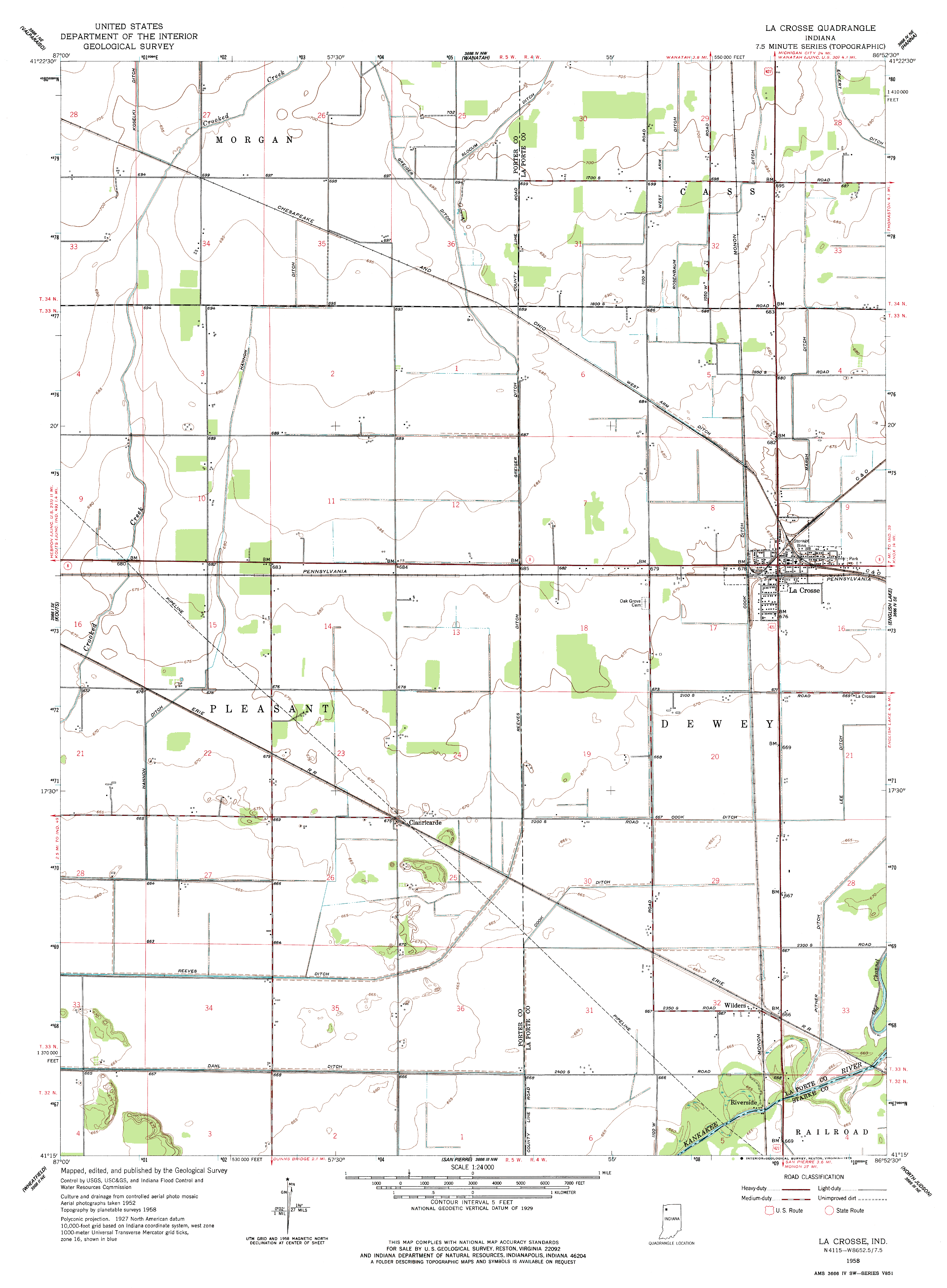 LaCrosse Quad |
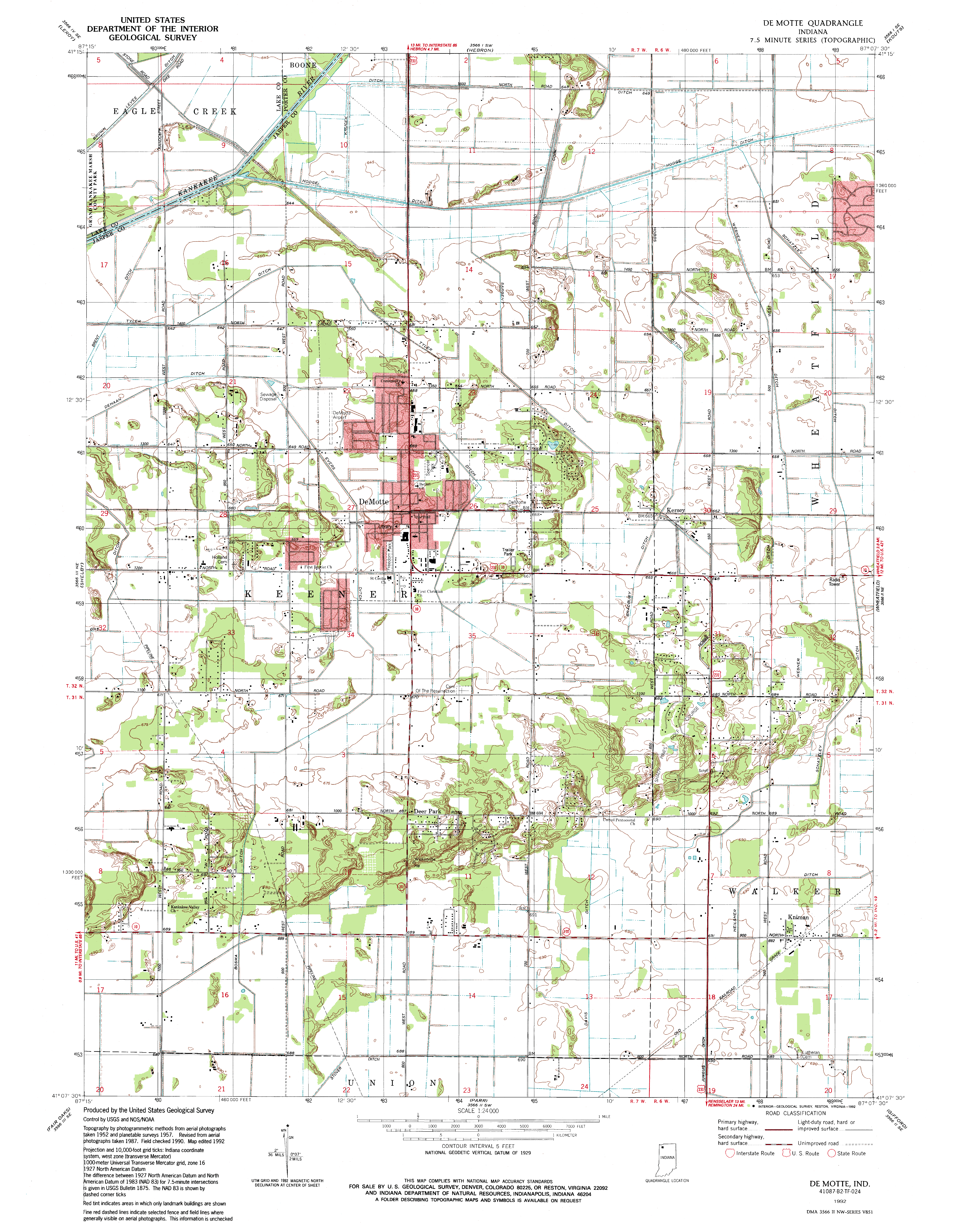 DeMotte Quad |
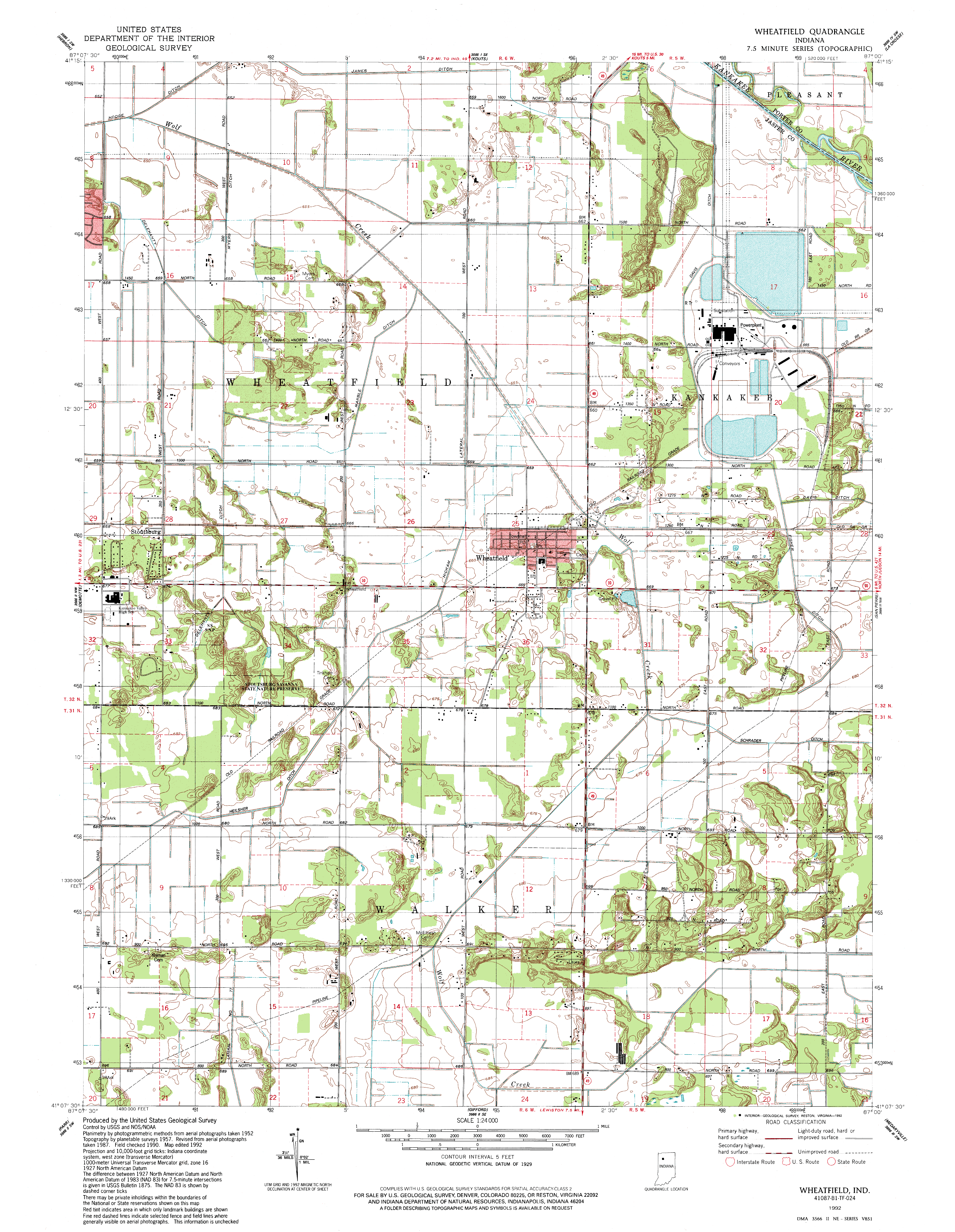 Wheatfield Quad |
 San Pierre Quad |