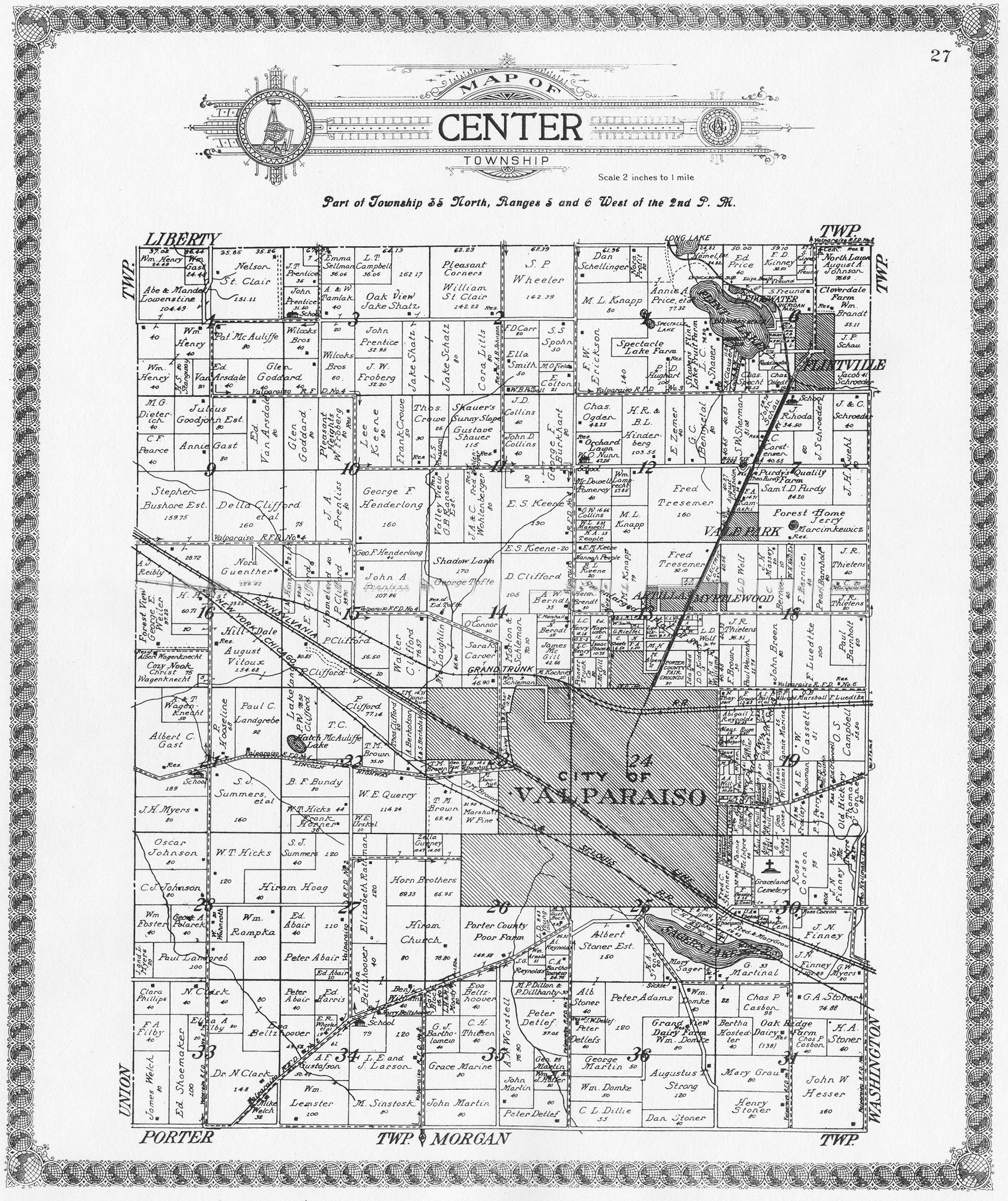
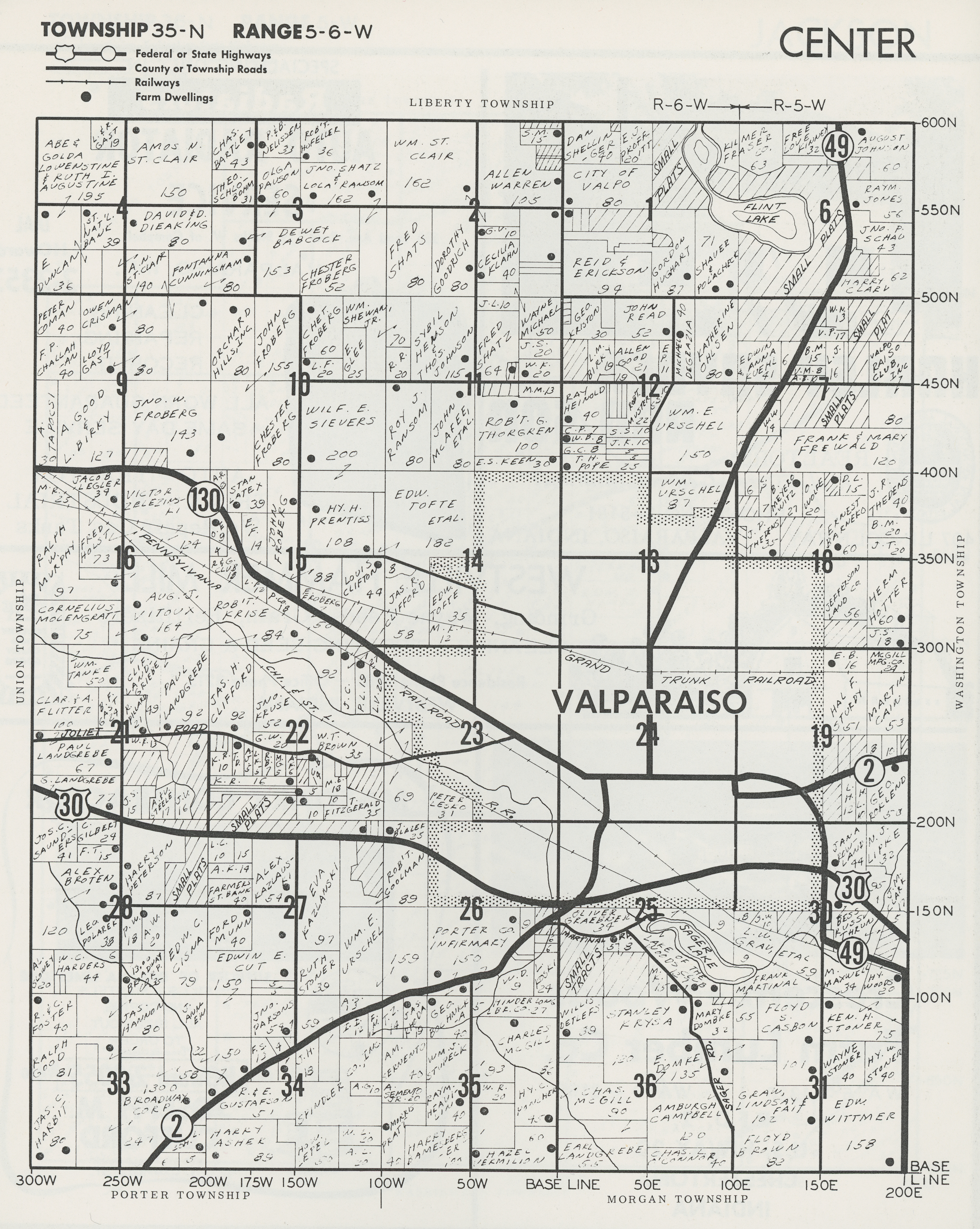
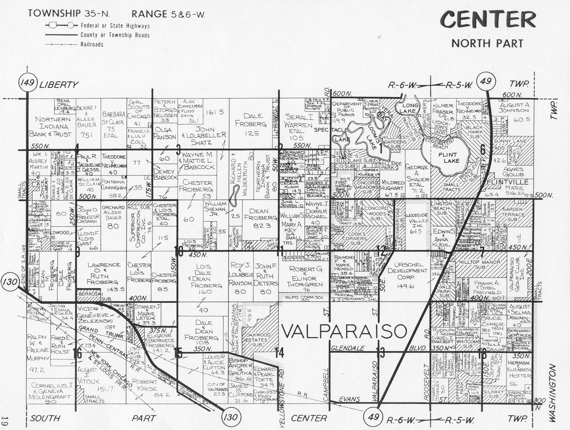
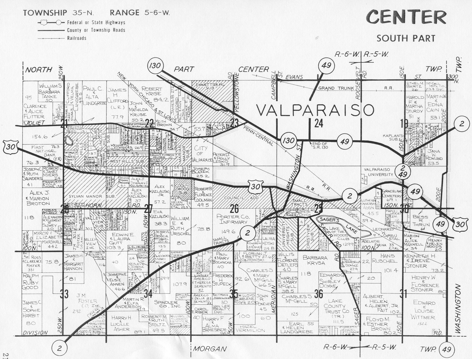
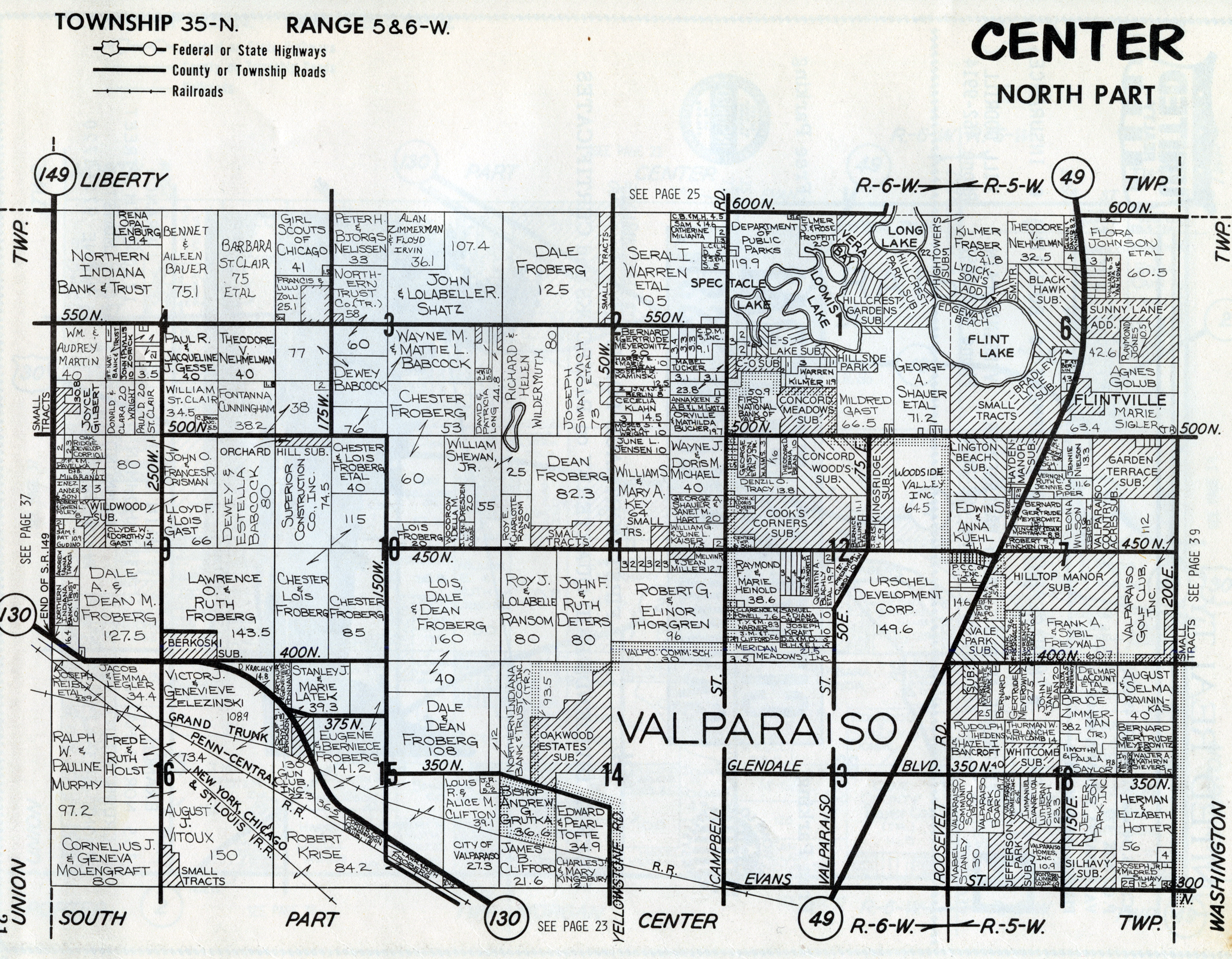
Center Township MapsCenter Township, Porter County plat maps . . . .
The following are Center Township, Porter County,
Indiana, maps available on this website. Click the links below to access
full size images. Note that several of these images are large files and may take
considerable time to load on slower Internet connections, such as dialup.
Original Land Patents
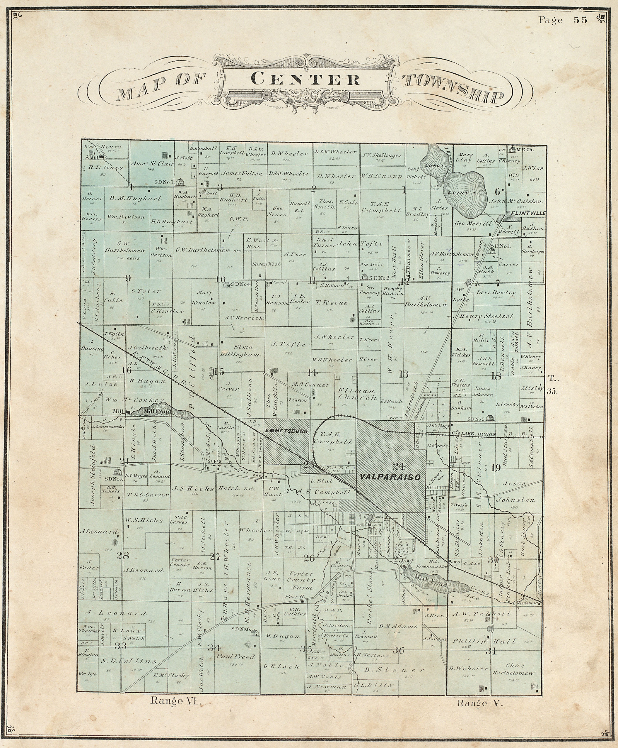
1876 Plat
Map
1895 Plat Map
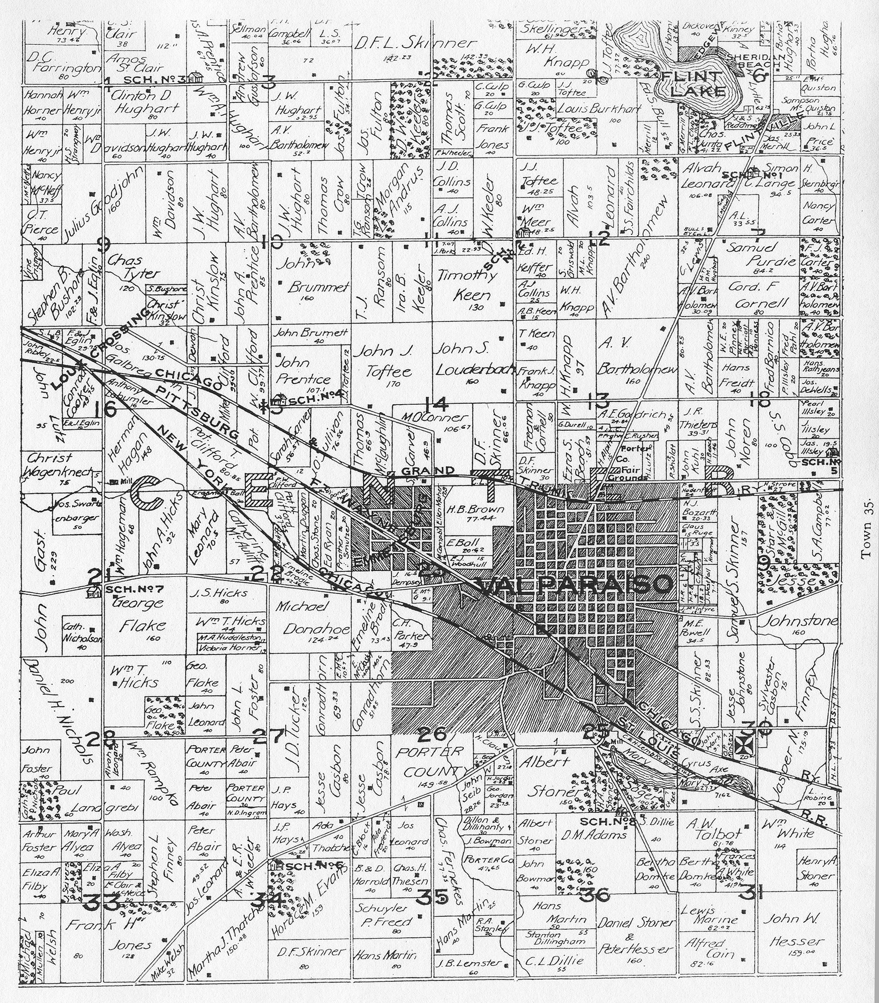
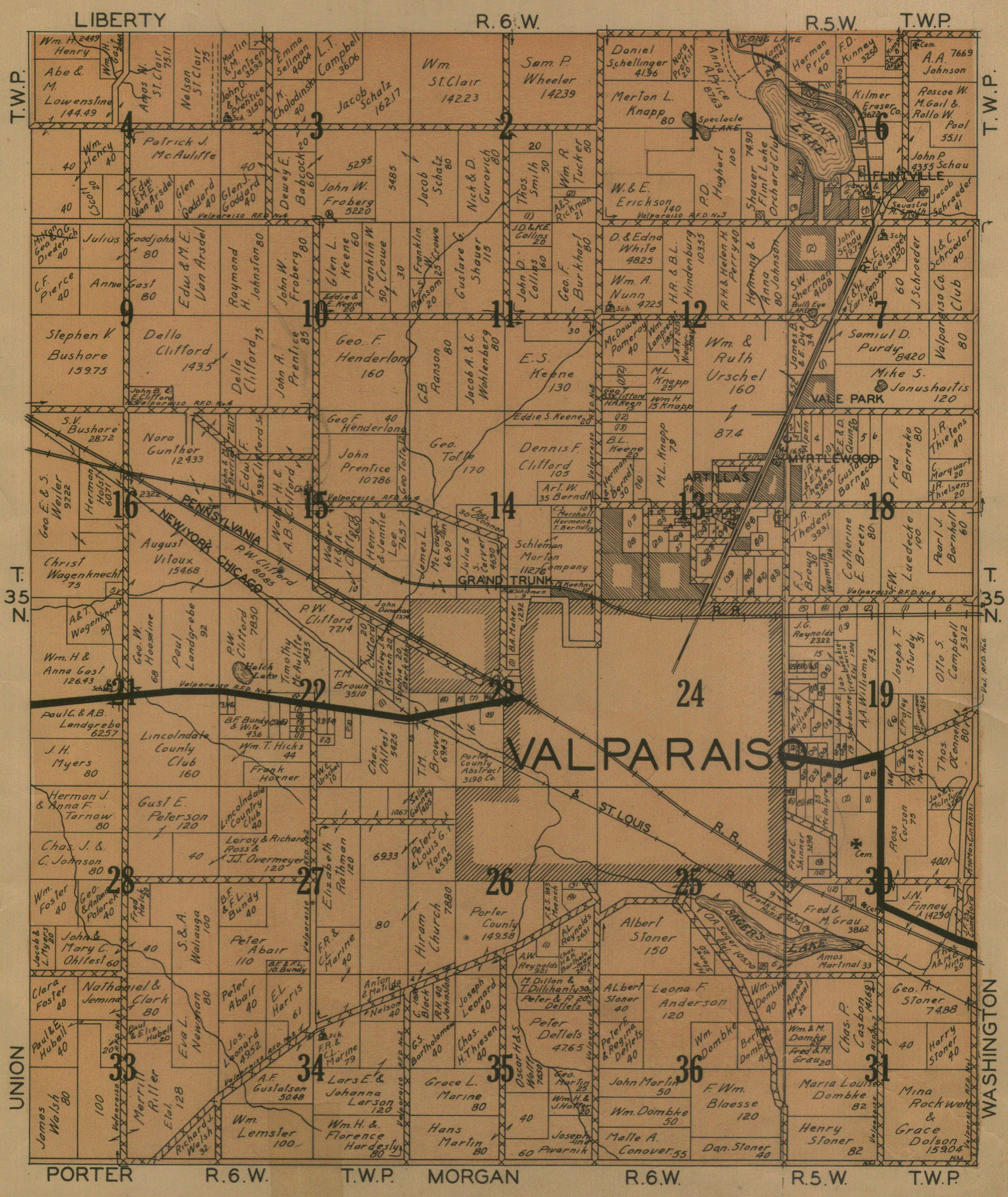
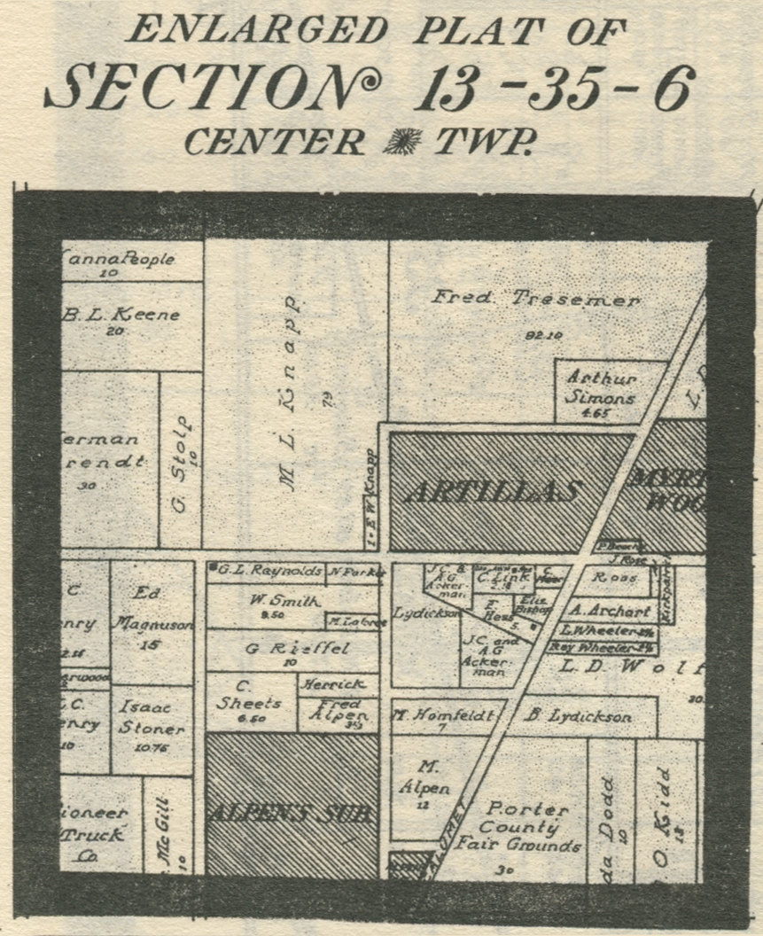
1906 Plat
Map
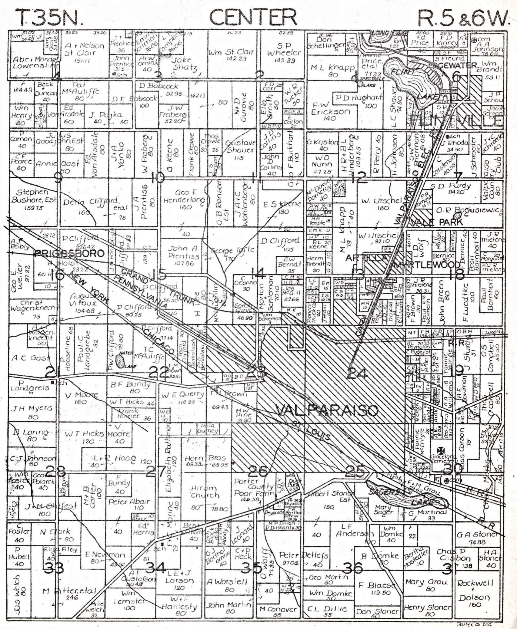
1921 Plat
Map
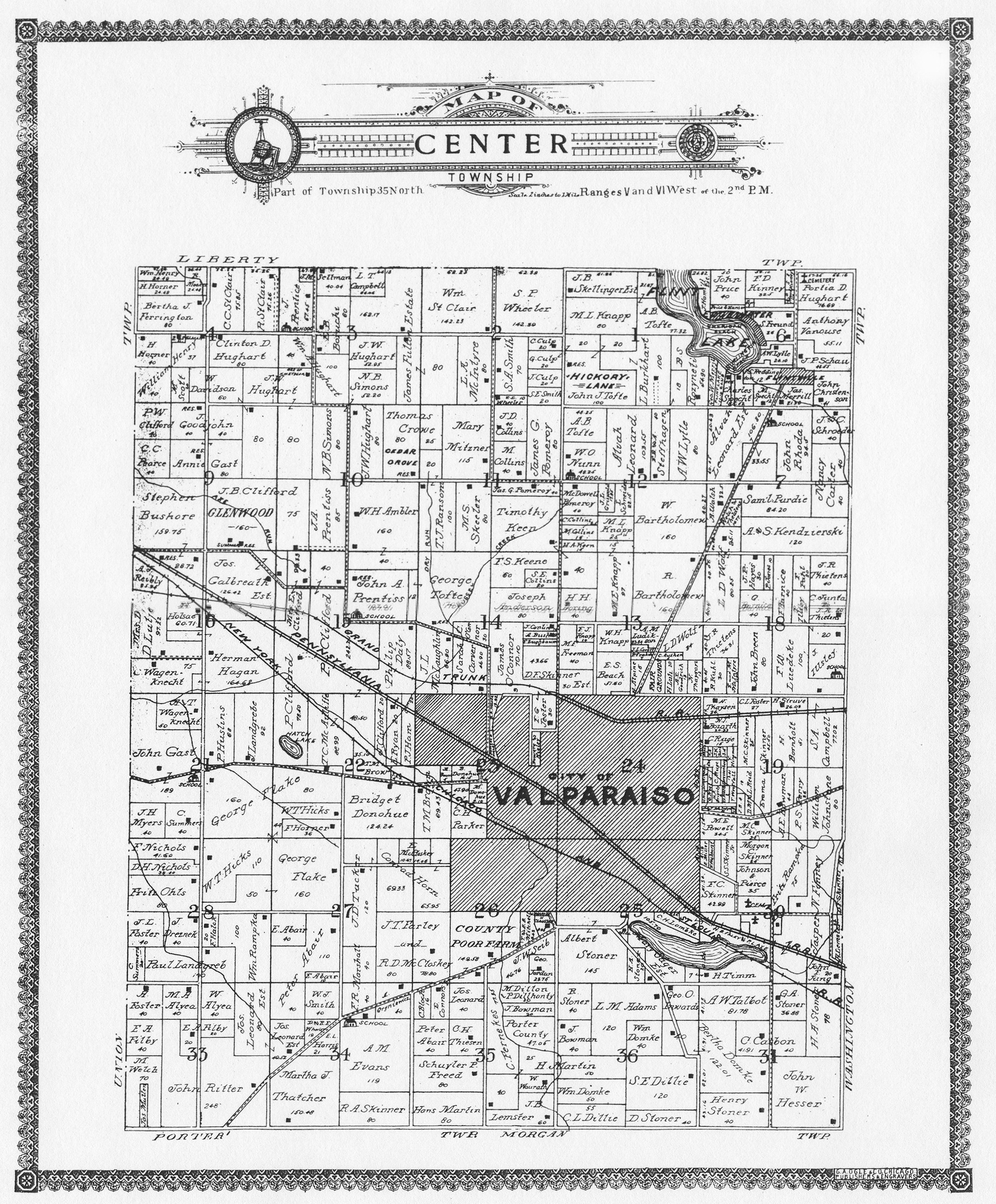
1928 Plat Map
1929 Plat Map
1938 Plat Map
1941 Plat Map
1948 Plat Map
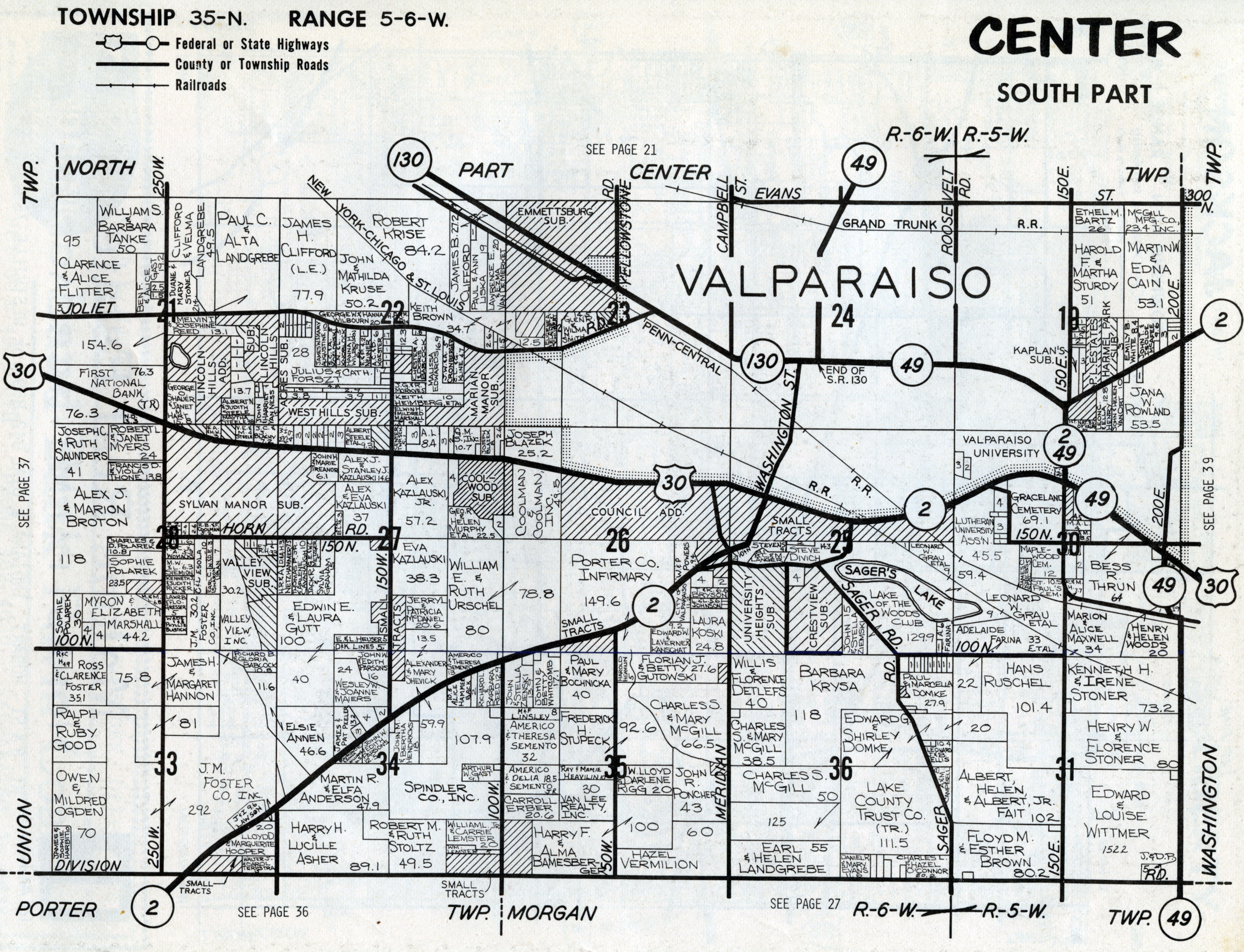
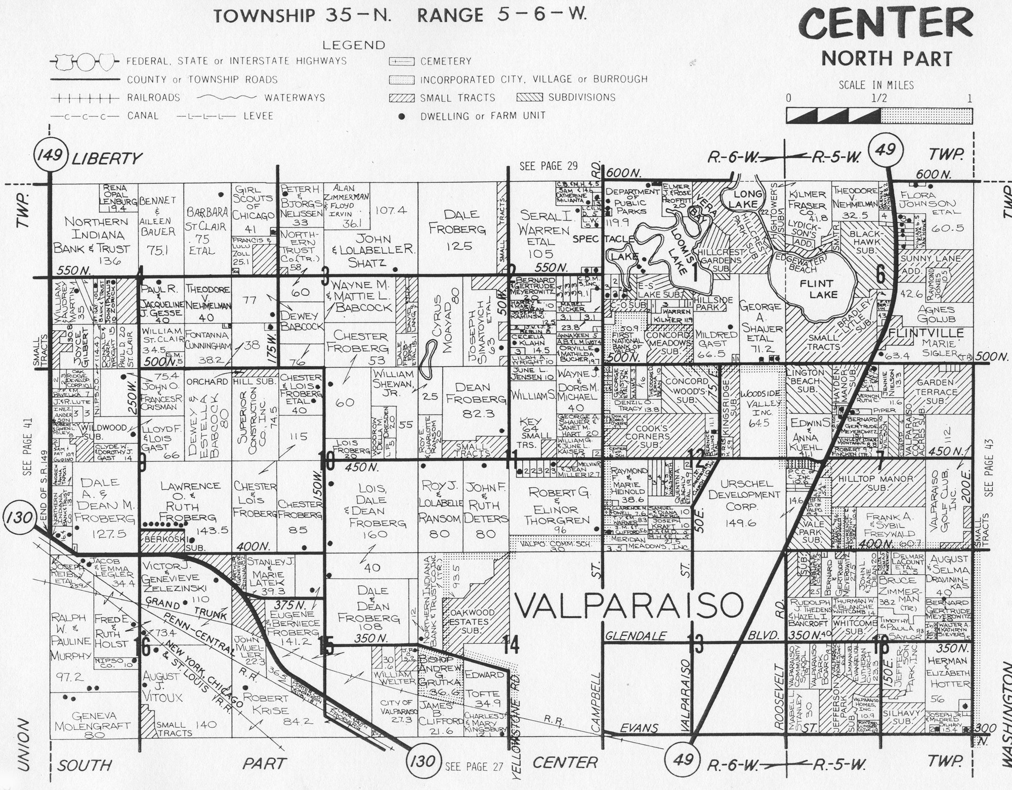
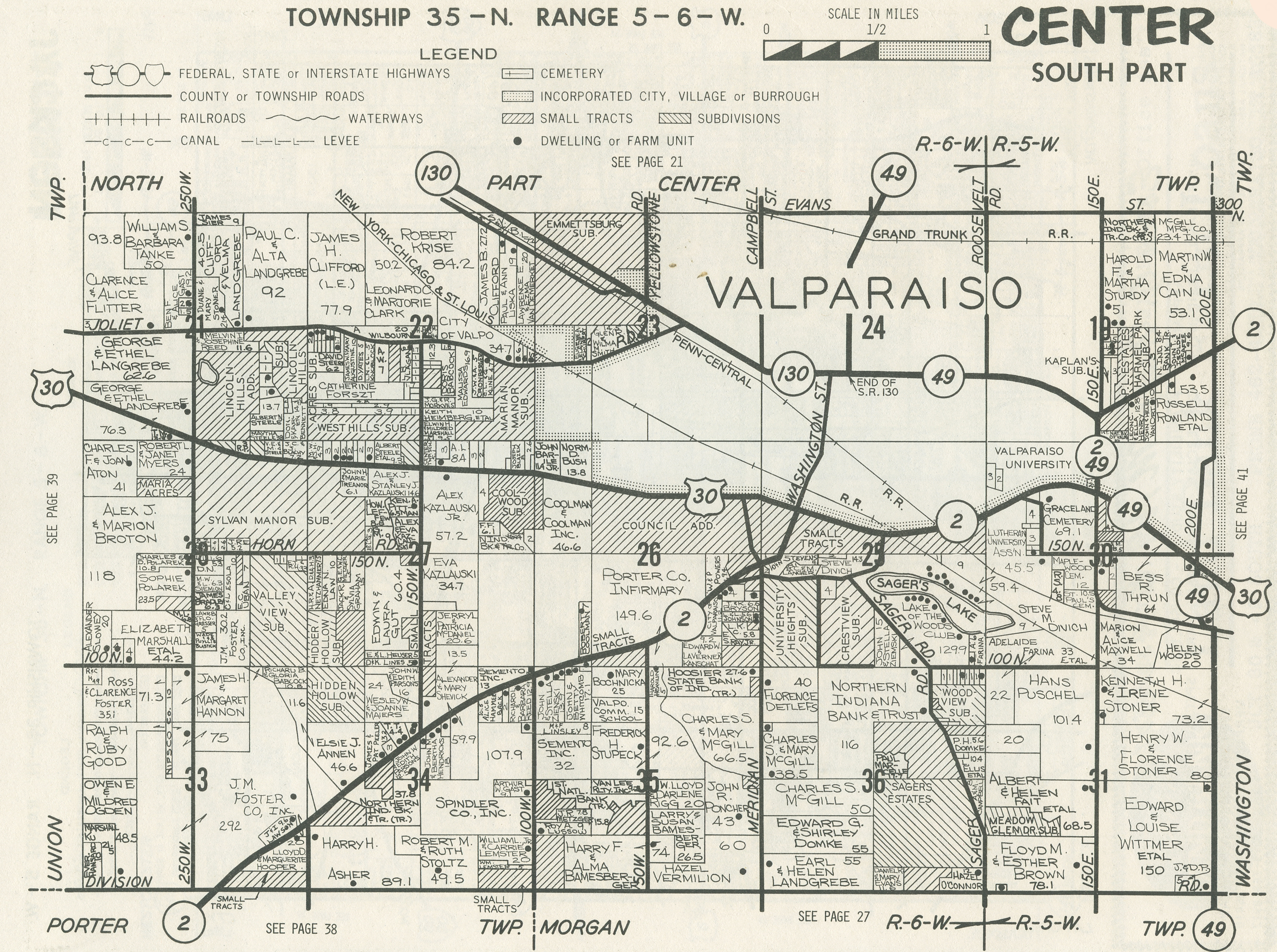
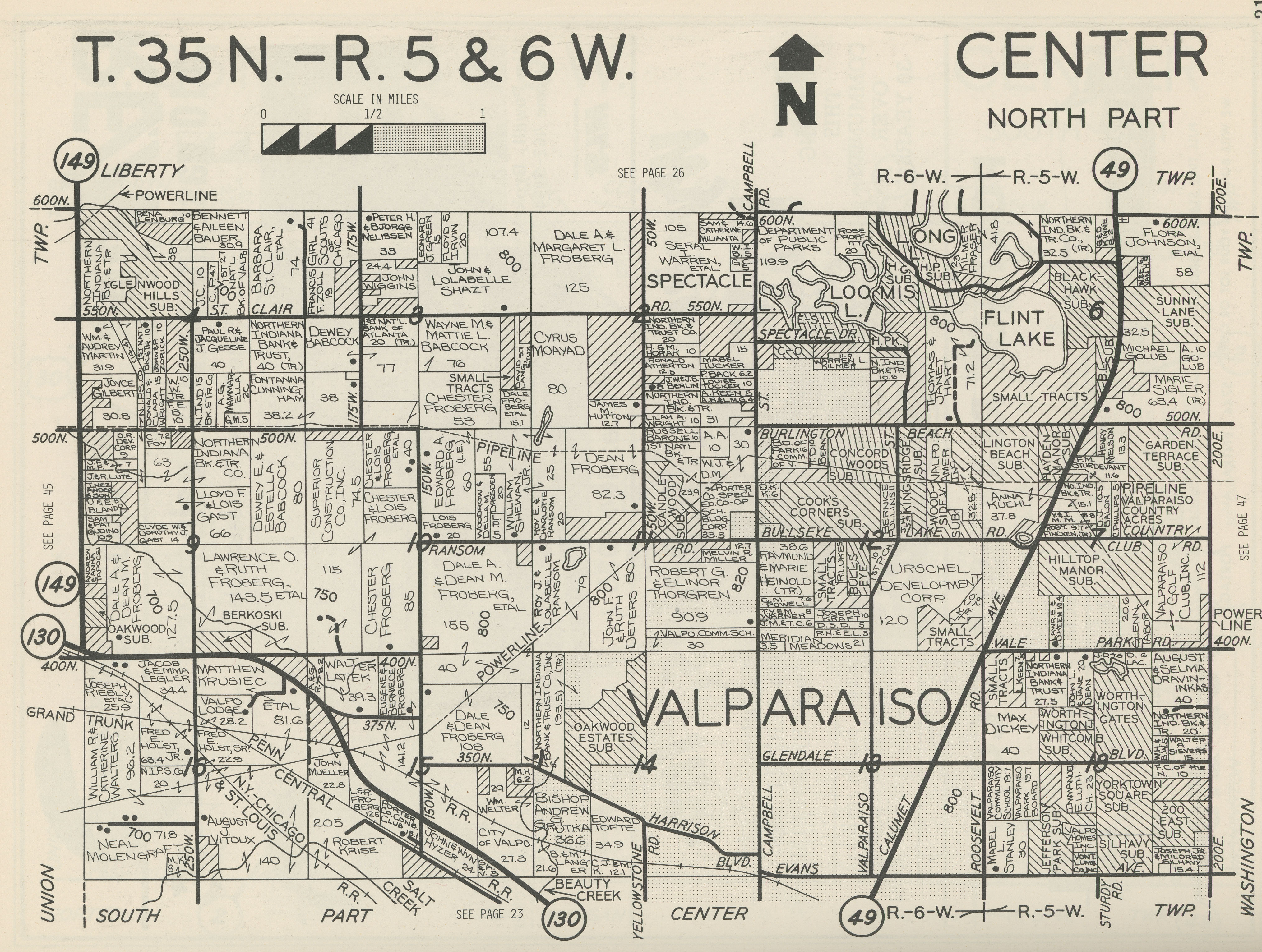
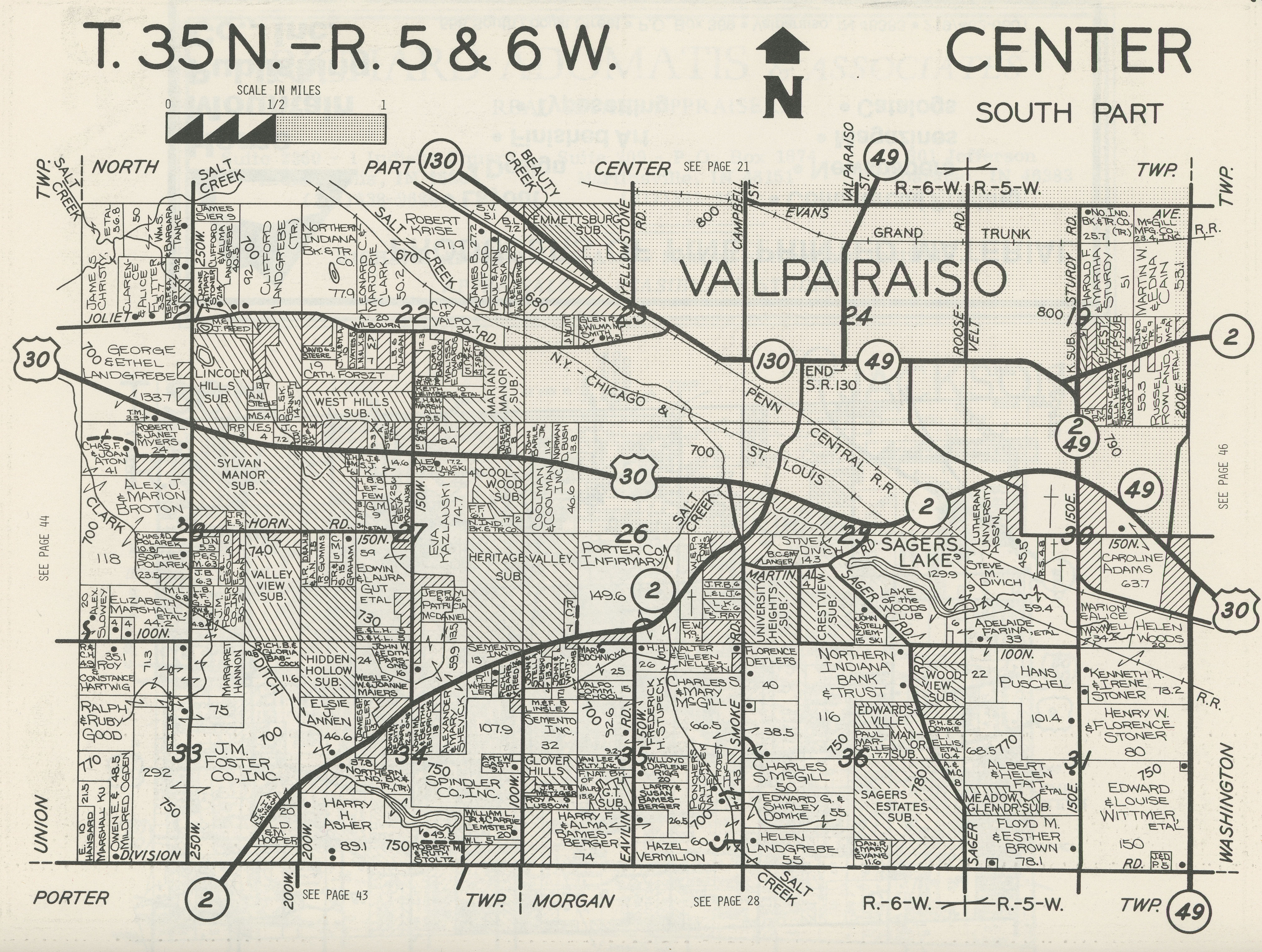
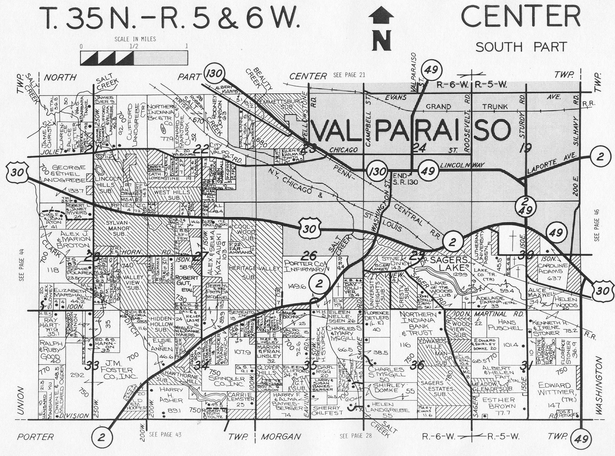
1958 Plat Map
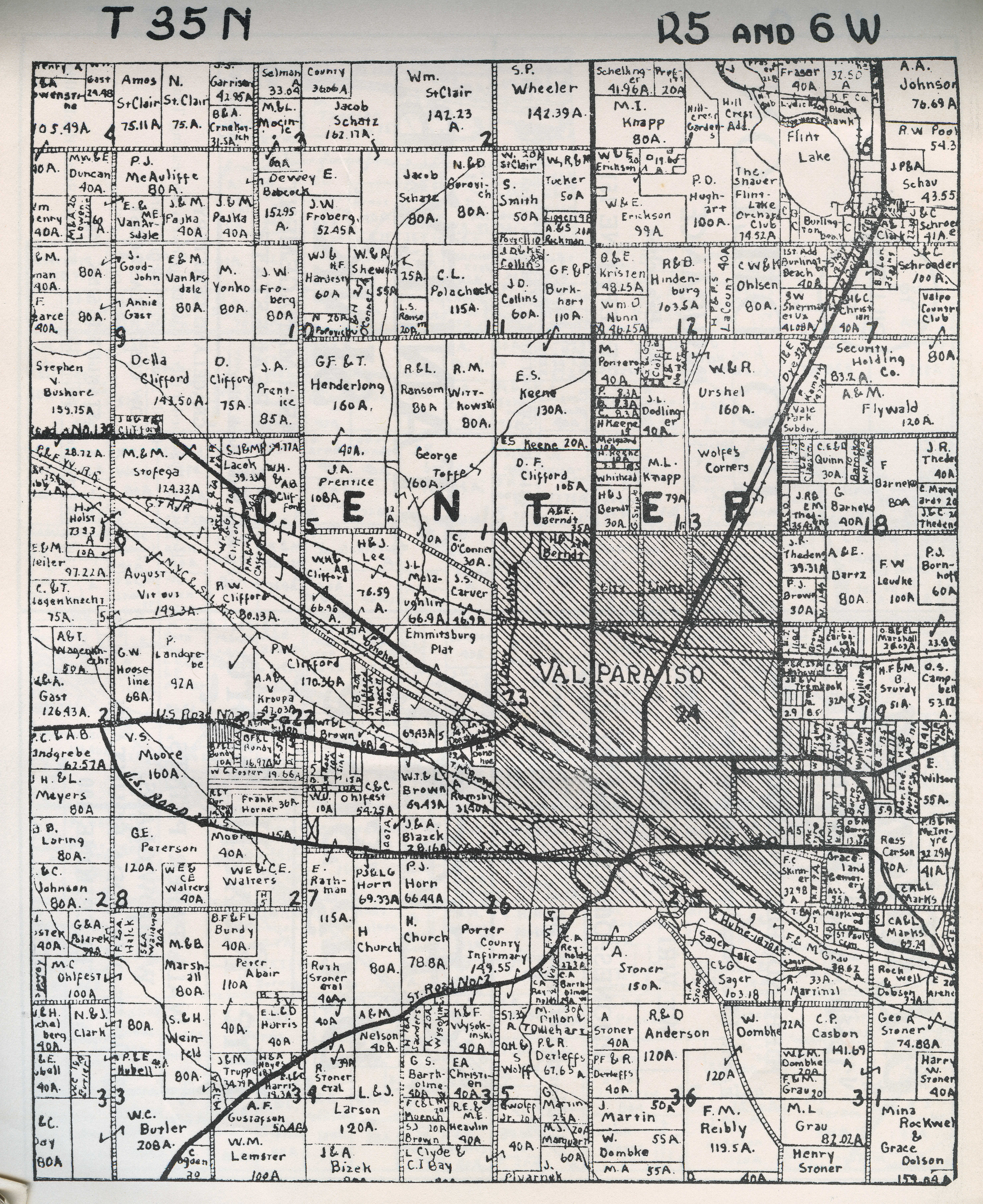
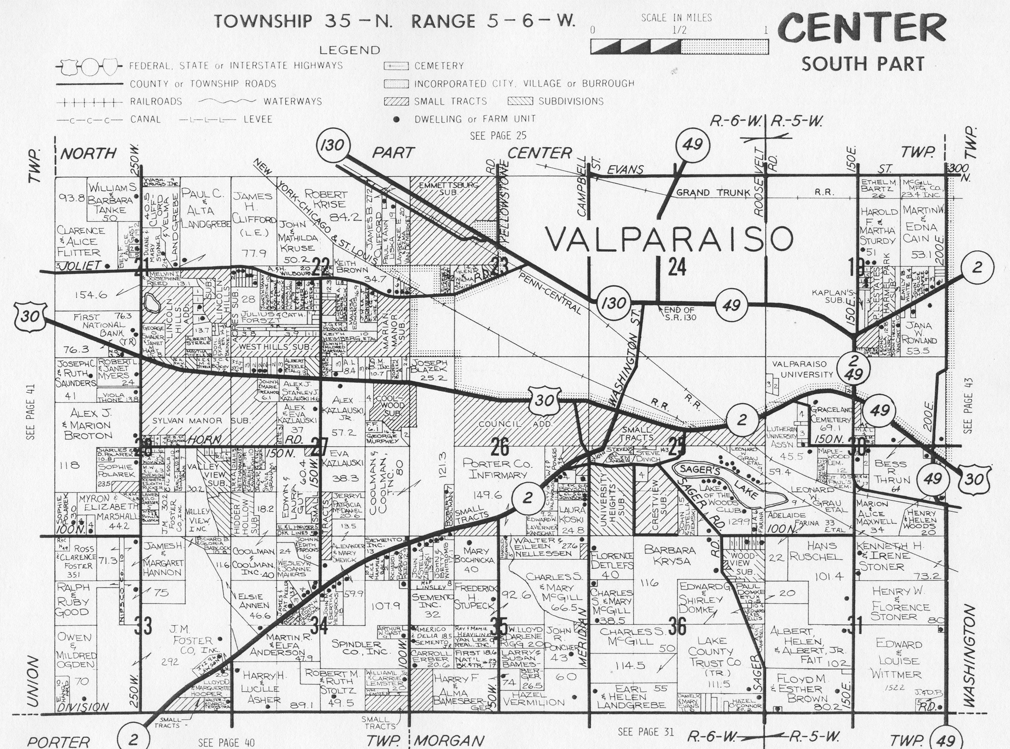
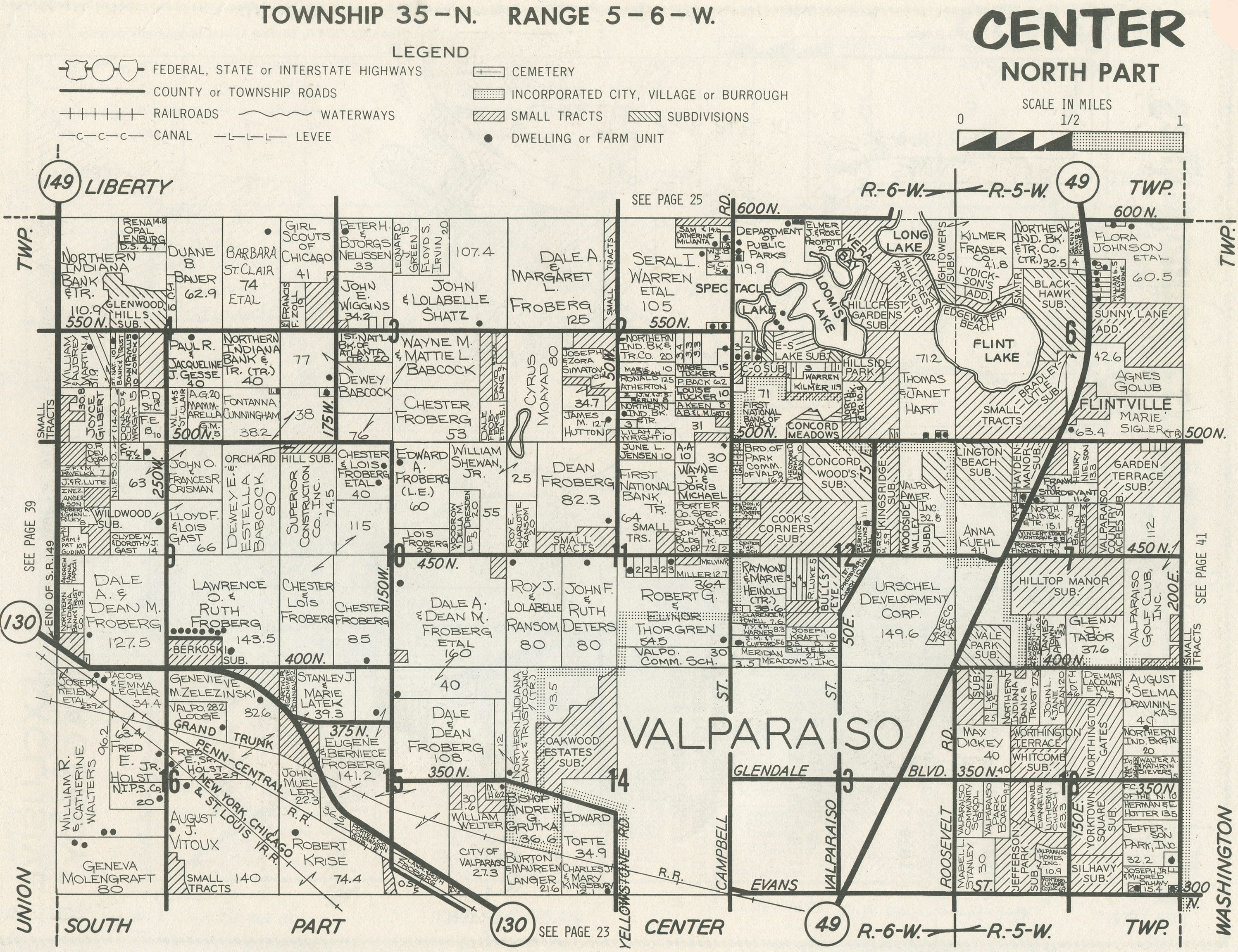
1969 Plat
Map
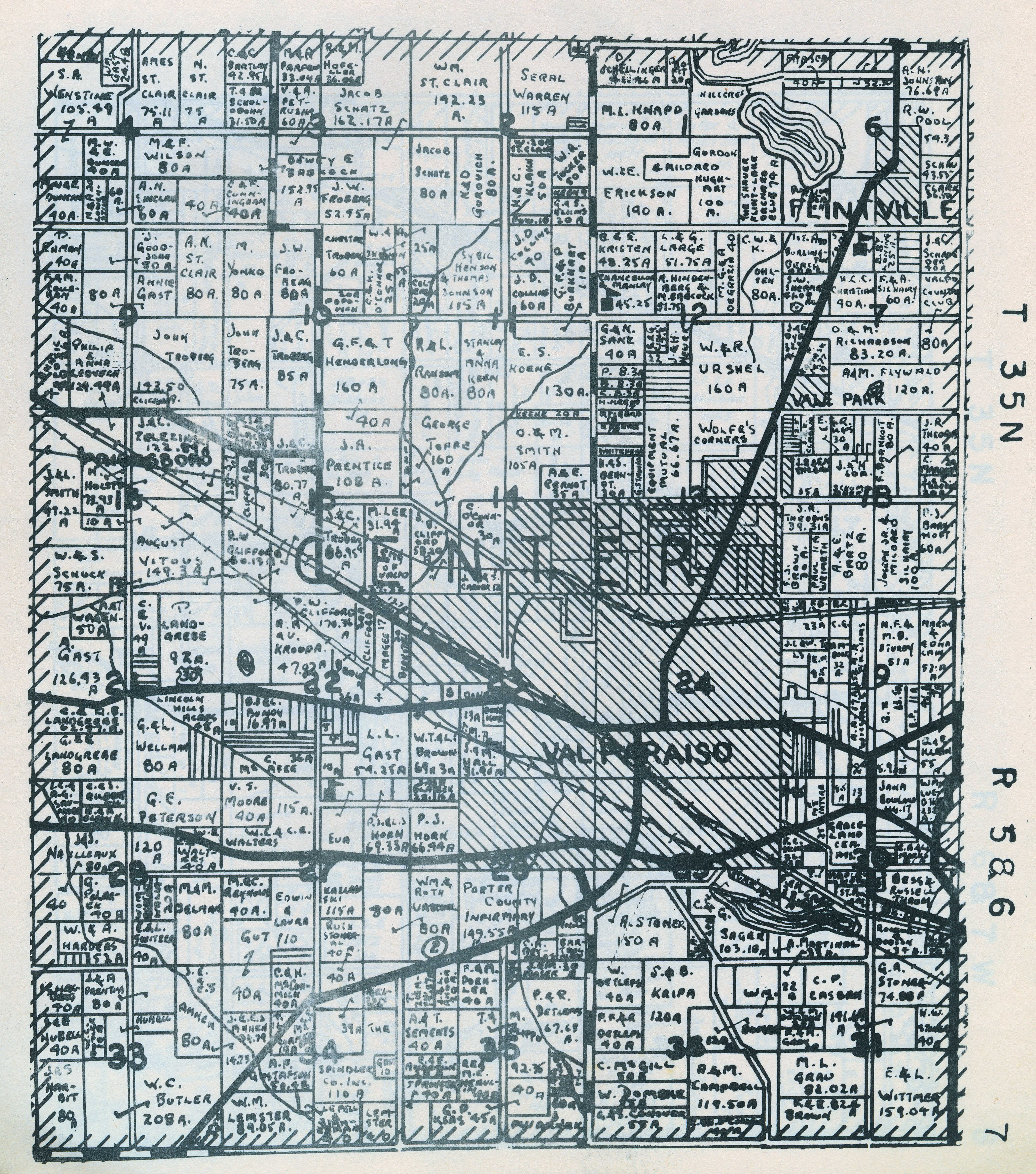
1973
Plat Map (North Half)
1973 Plat Map (South Half)
1974 Plat Map (North Half)
1974 Plat Map (South Half)
1976 Plat Map (North
Half)
1976 Plat Map (South
Half)
1979
Plat Map (North Half)
1979
Plat Map (South Half)
1982 Plat
Map (North Half)
1982 Plat
Map (South Half)
1984 Plat
Map (North Half)
1984 Plat
Map (South Half)
1988 Plat Map (North Half)
1988 Plat Map (South Half)
Center Township Town and Village Plats
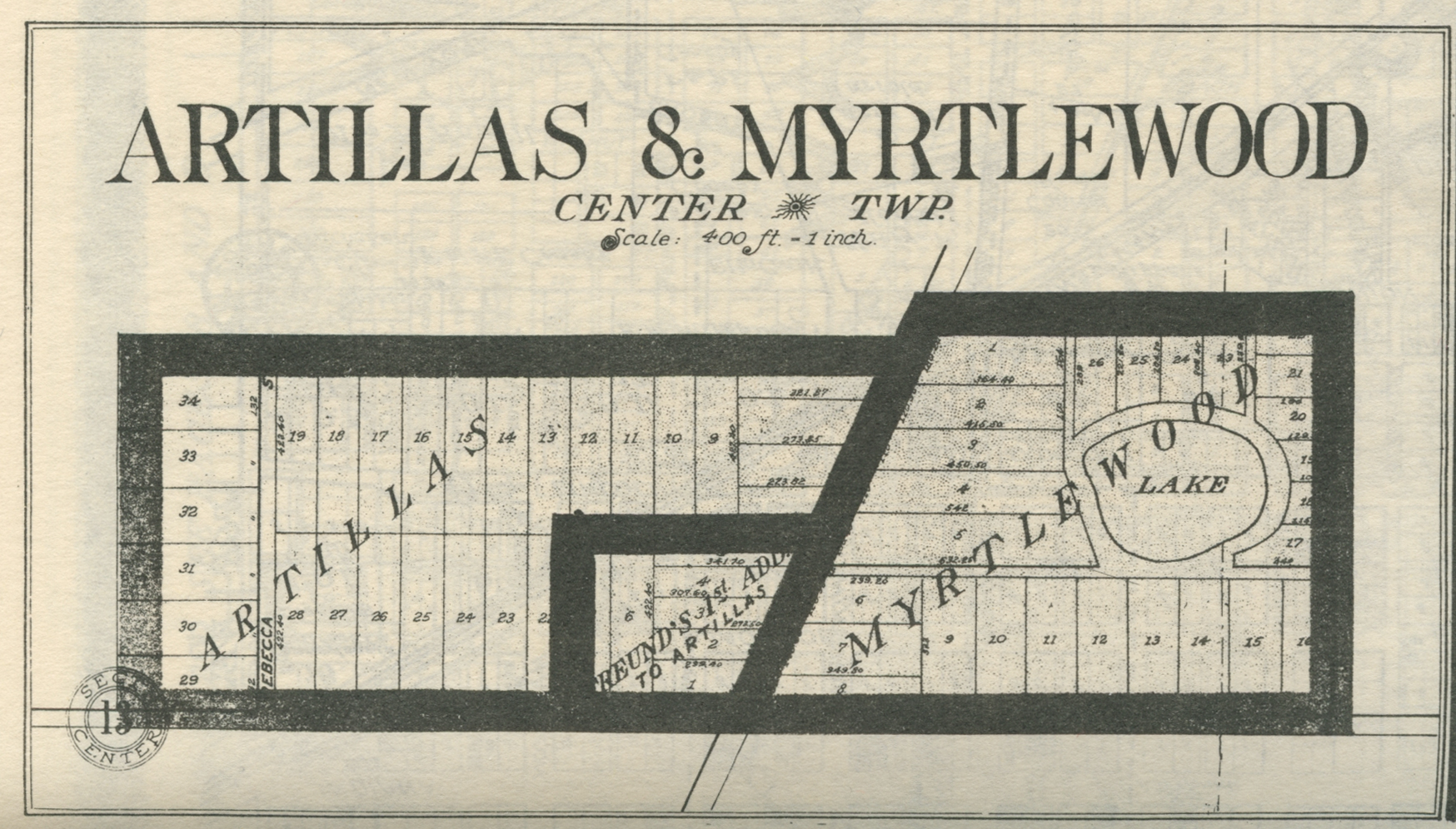
Artillas and Myrtlewood Additions - Part I, 1921
Artillas and Myrtlewood Additions - Part II, 1921
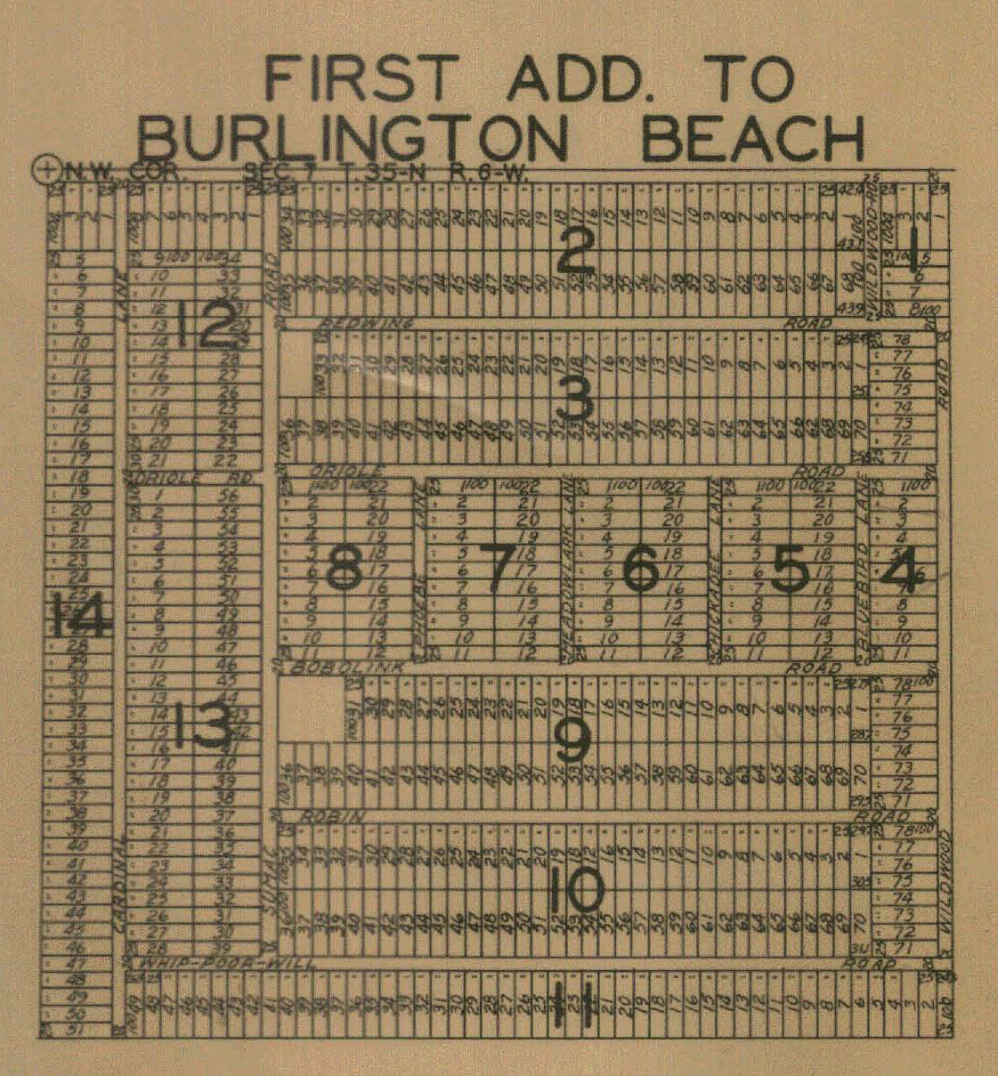
Burlington Beach - Part I, 1928
Burlington Beach - Part II, 1928
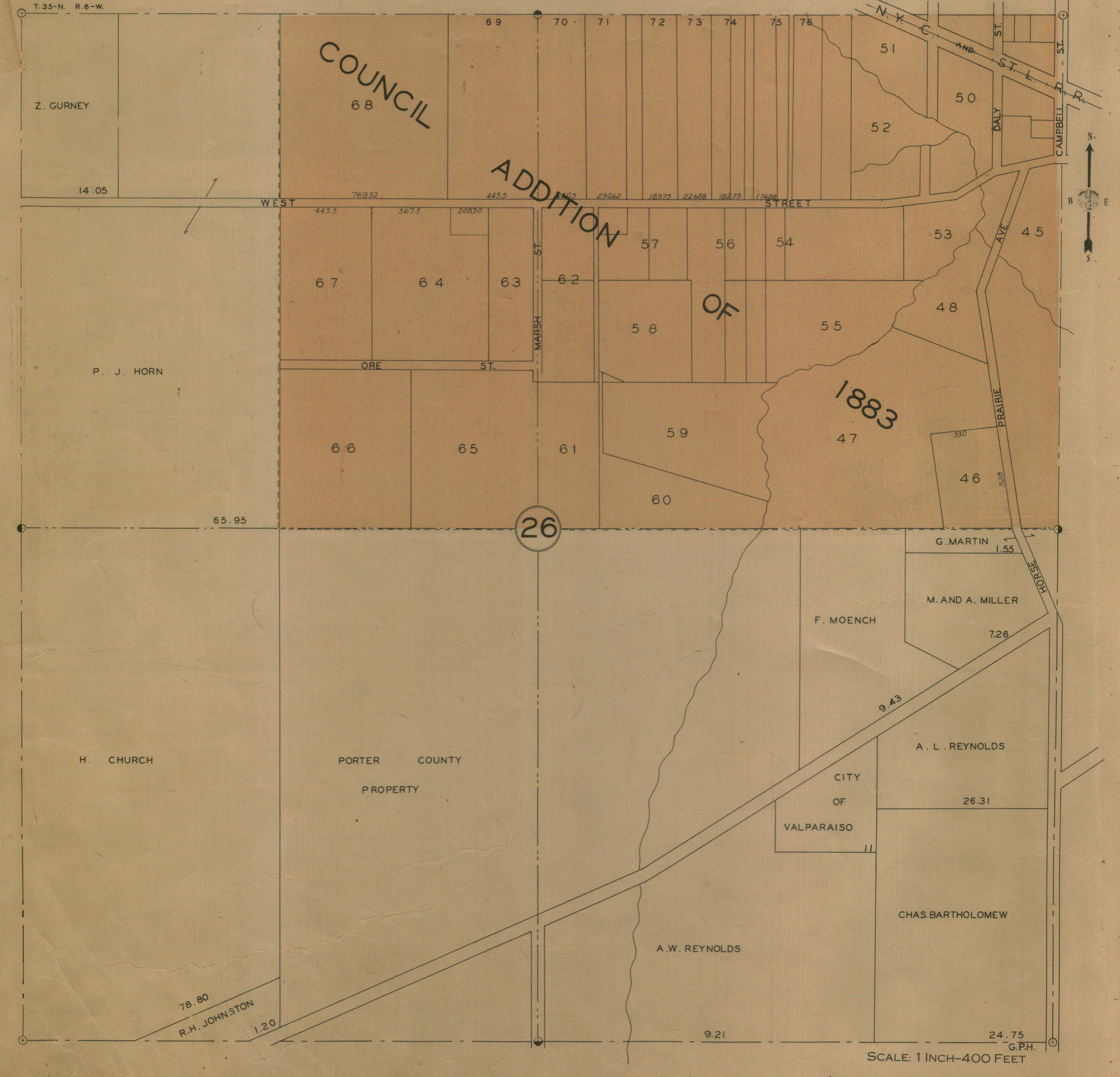
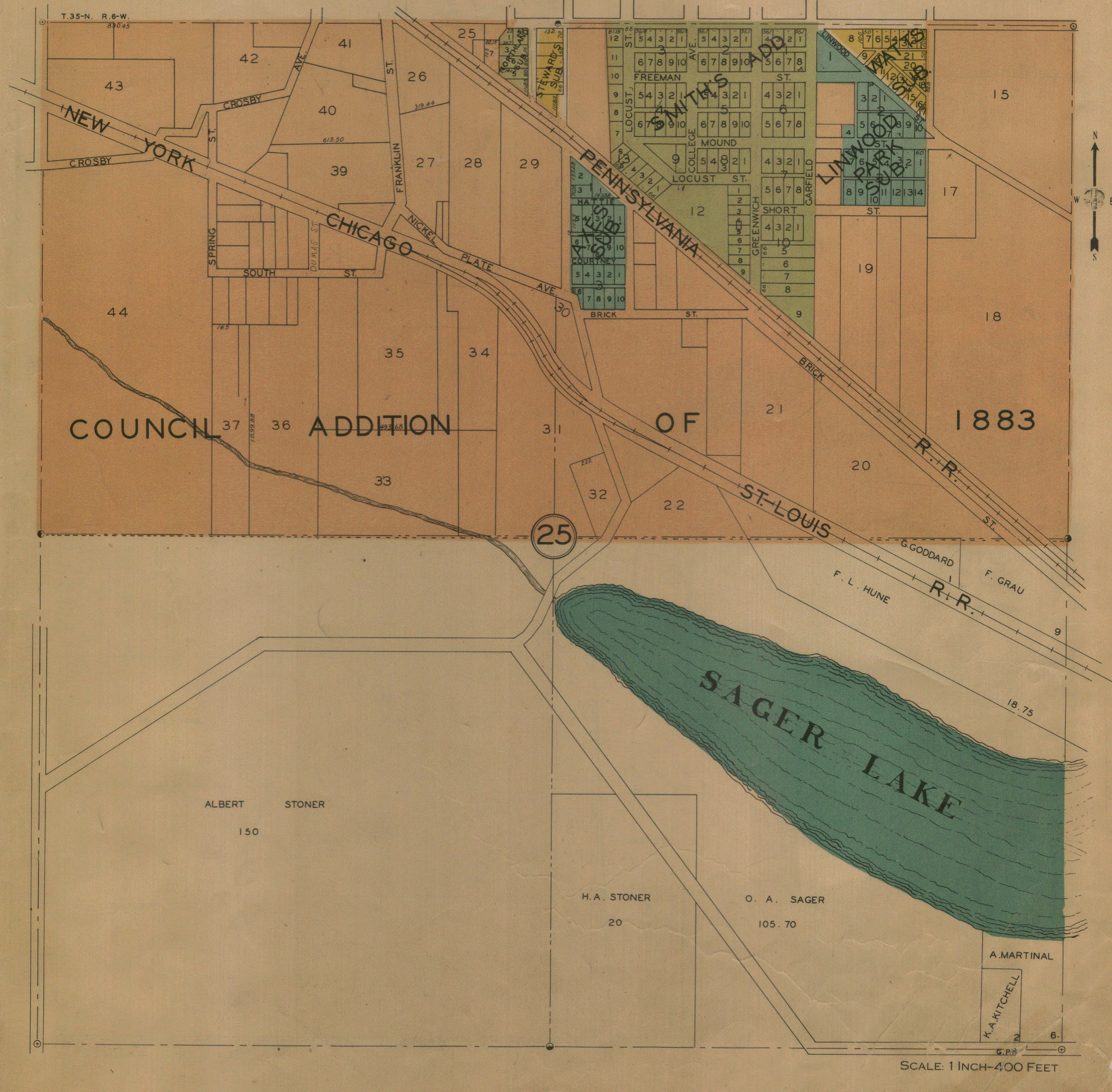
Council Addition of 1883 - Part I, 1928
Council Addition of 1883 - Part II, 1928
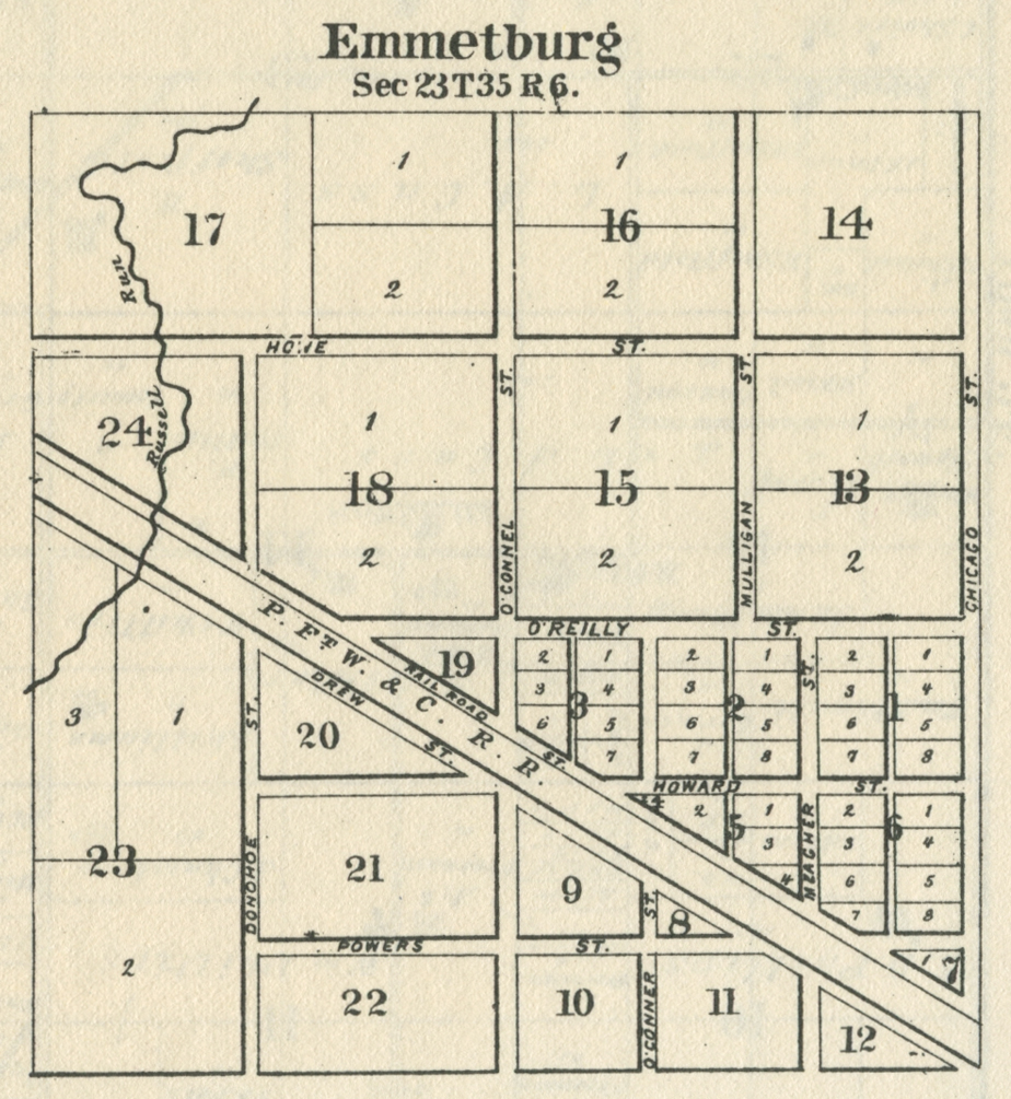
Emmetsburg, 1876
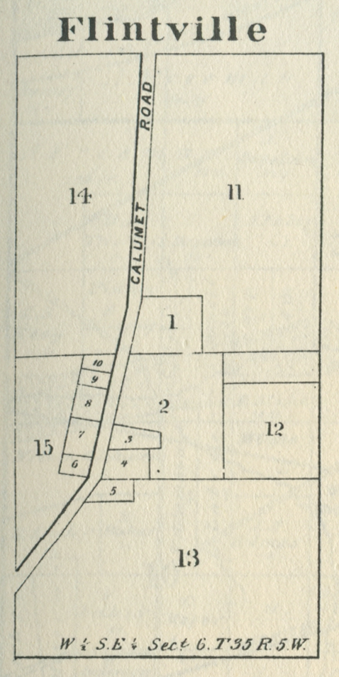
Flintville, 1876
Flintville, 1928
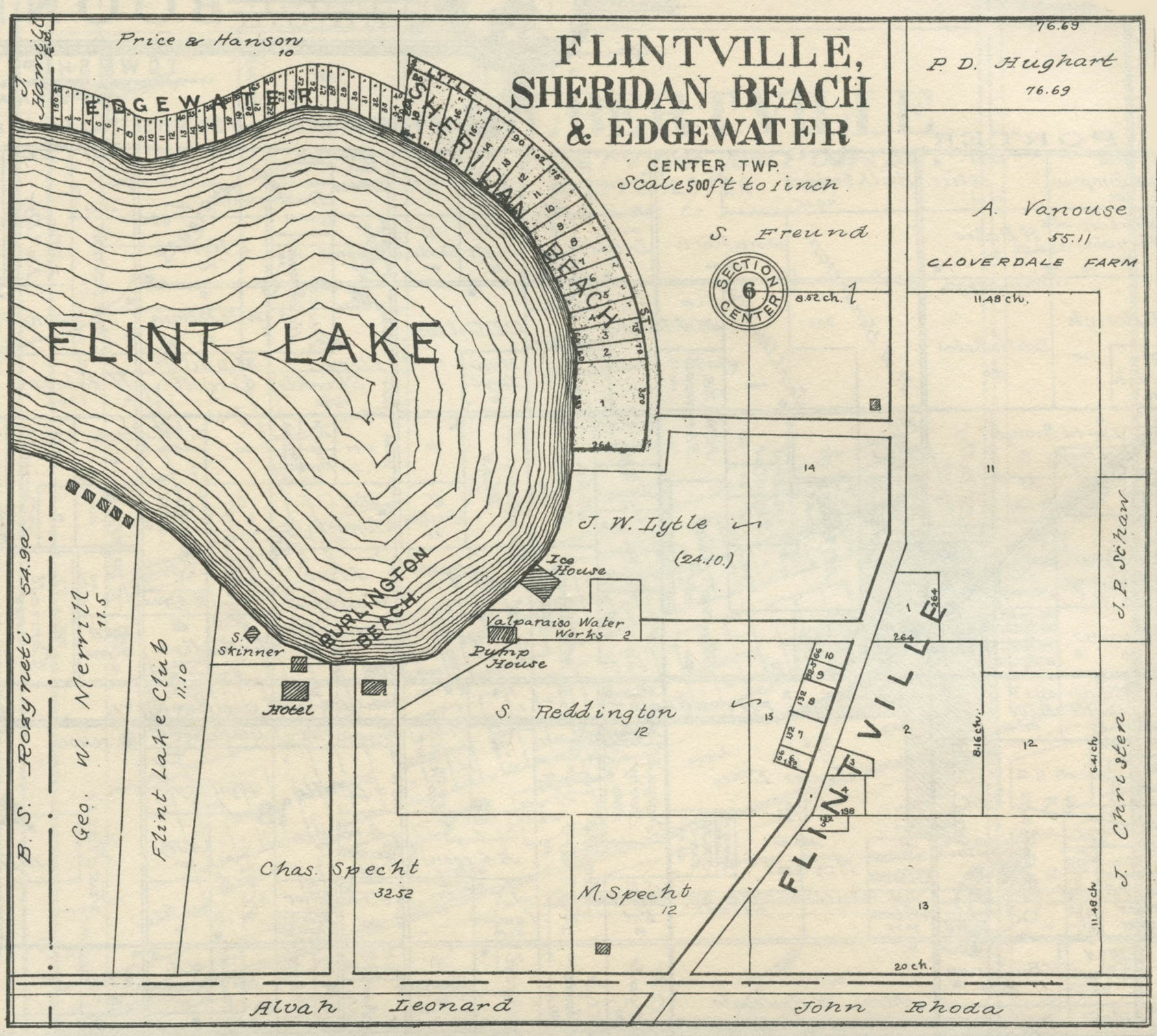
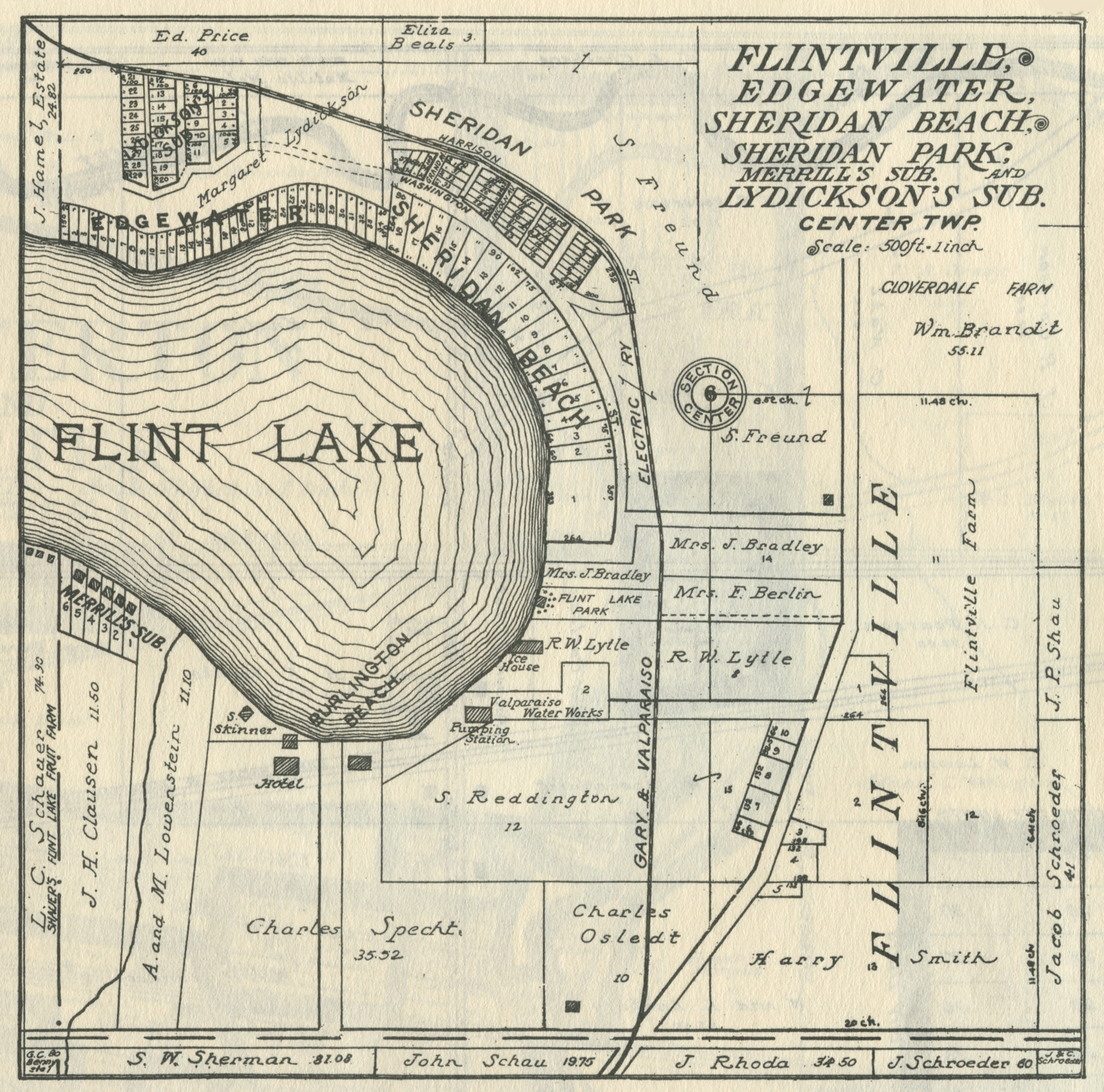
Flintville, Edgewater, and Sheridan Beach, 1906
Flintville, Edgewater, and Sheridan Beach, 1921
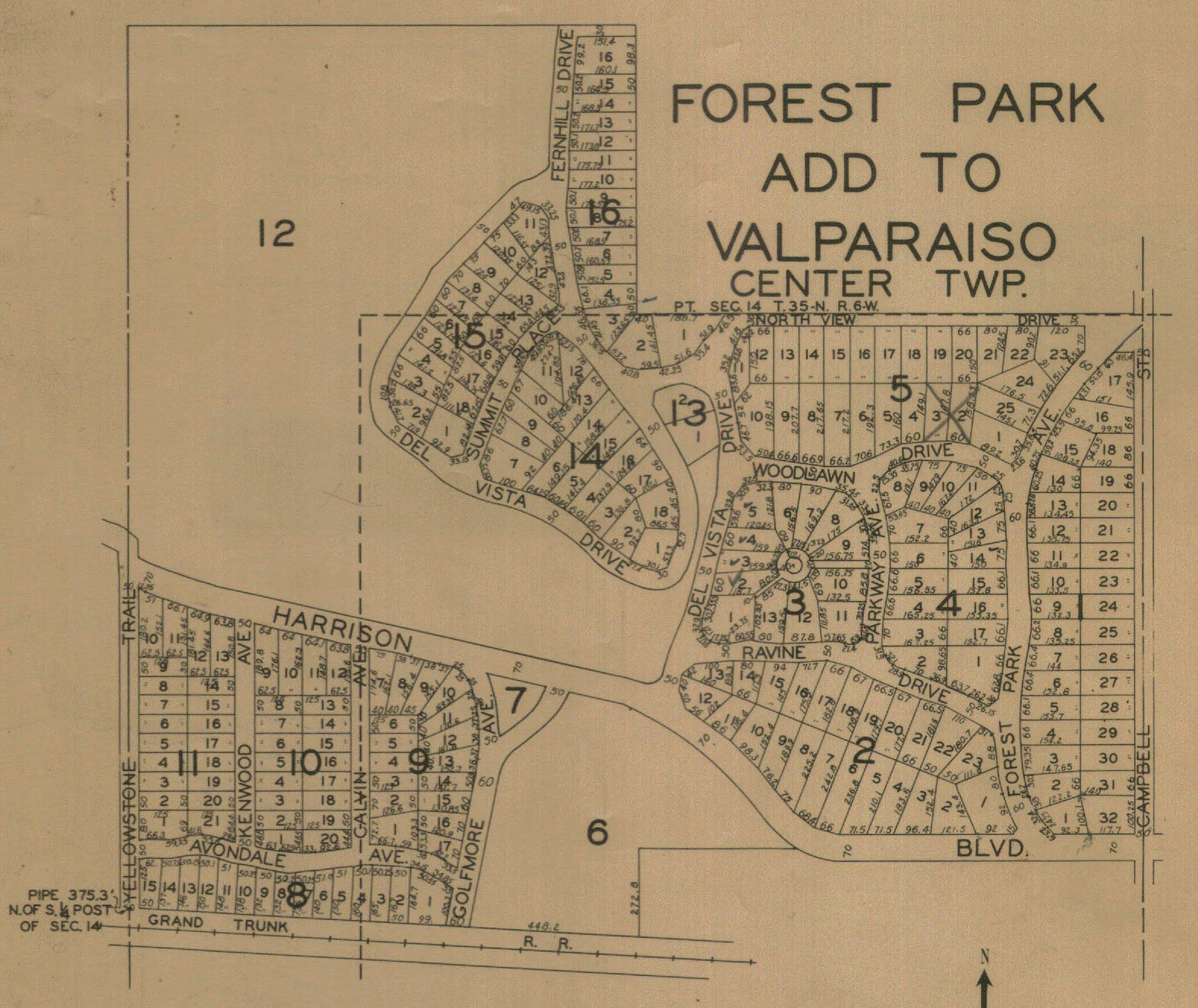
Forest Park Addition, 1928
Hightower's Channel, 1928
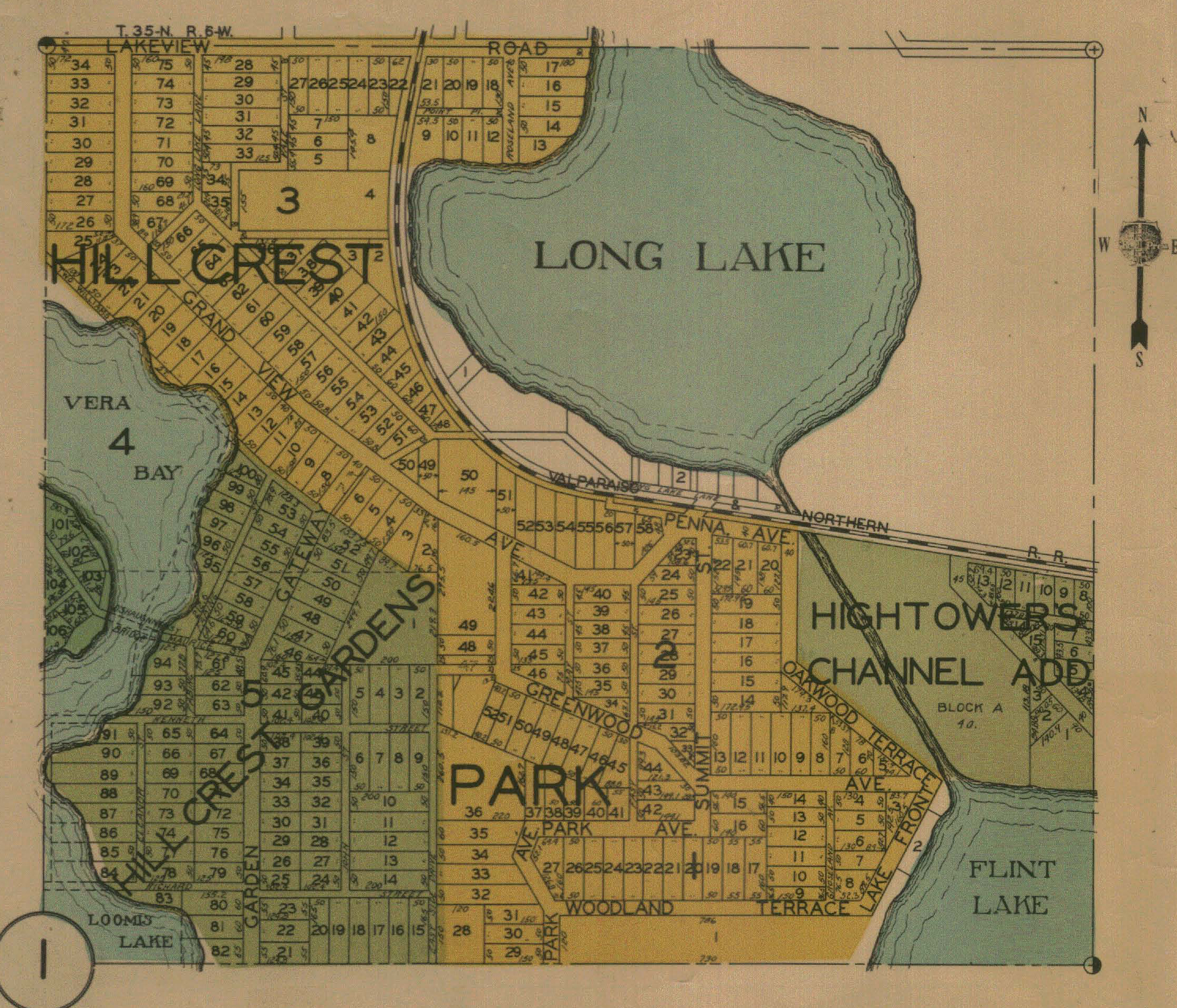
Hillcrest Garden, 1928
Hillcrest Park, 1928
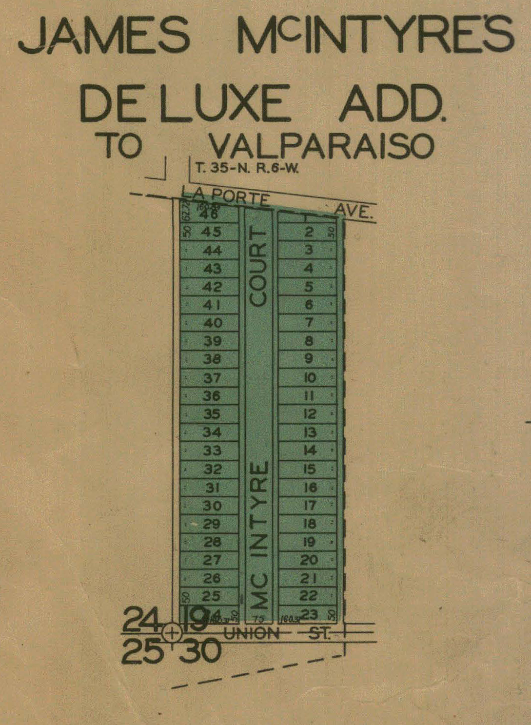
James McIntyre's Deluxe Addition, 1928
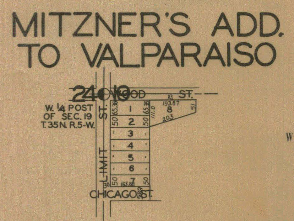
Mintzer's Addition, 1928
Portersville, 1836
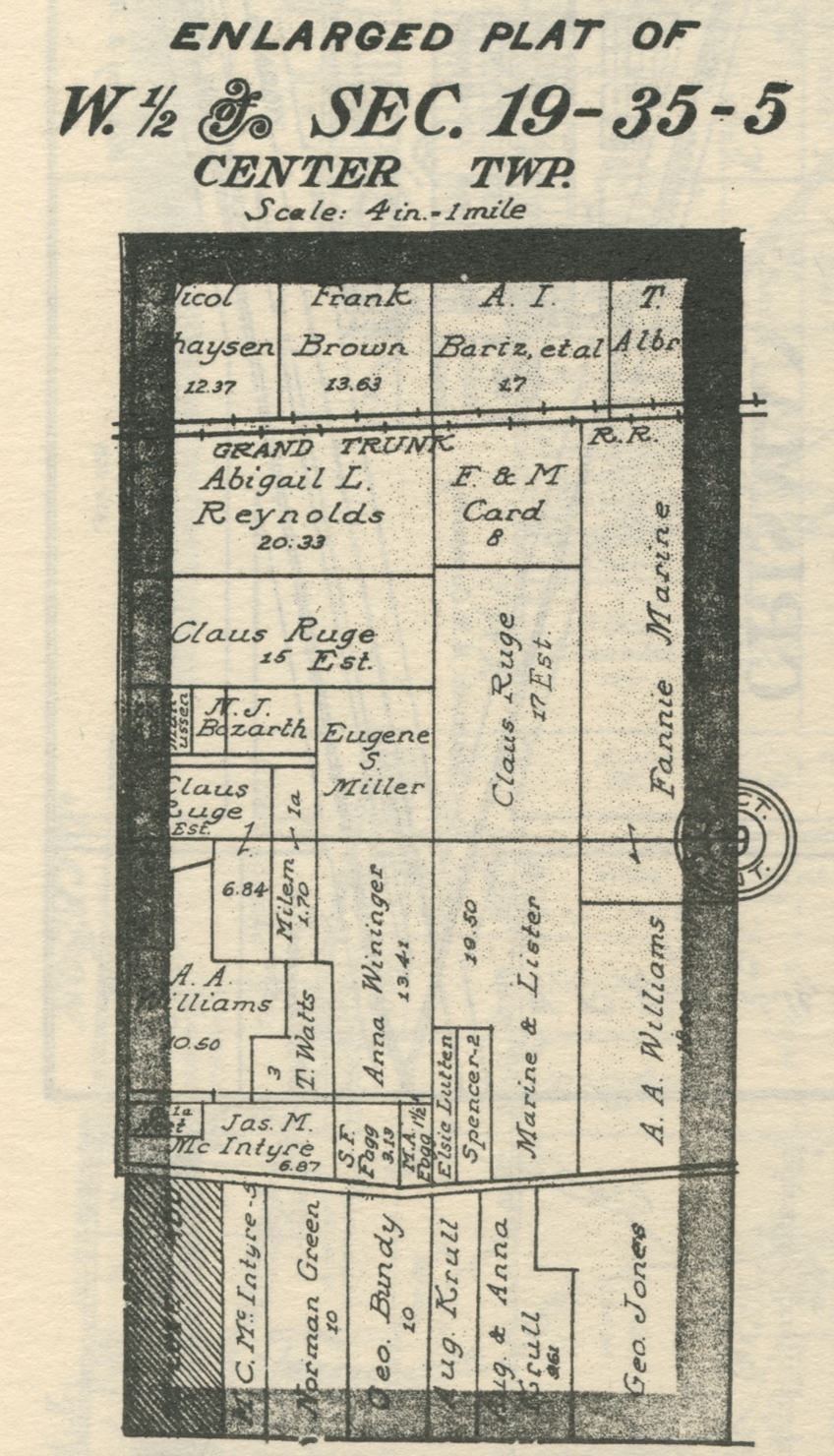
Section 19, West Half
Sheridan Beach, 1928
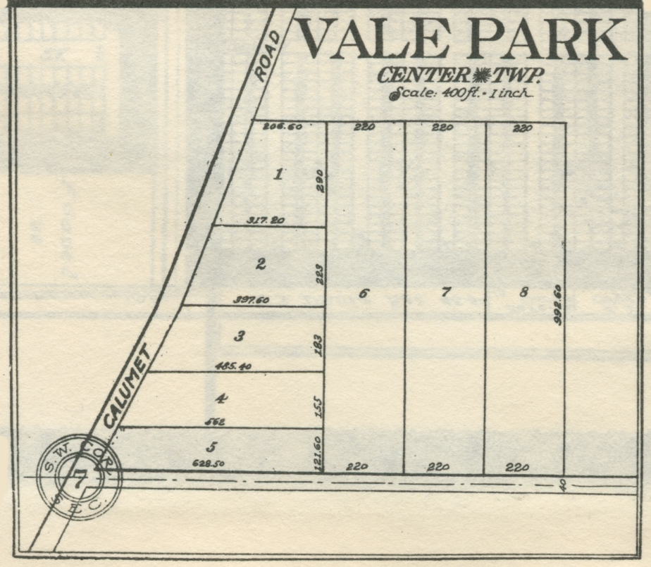
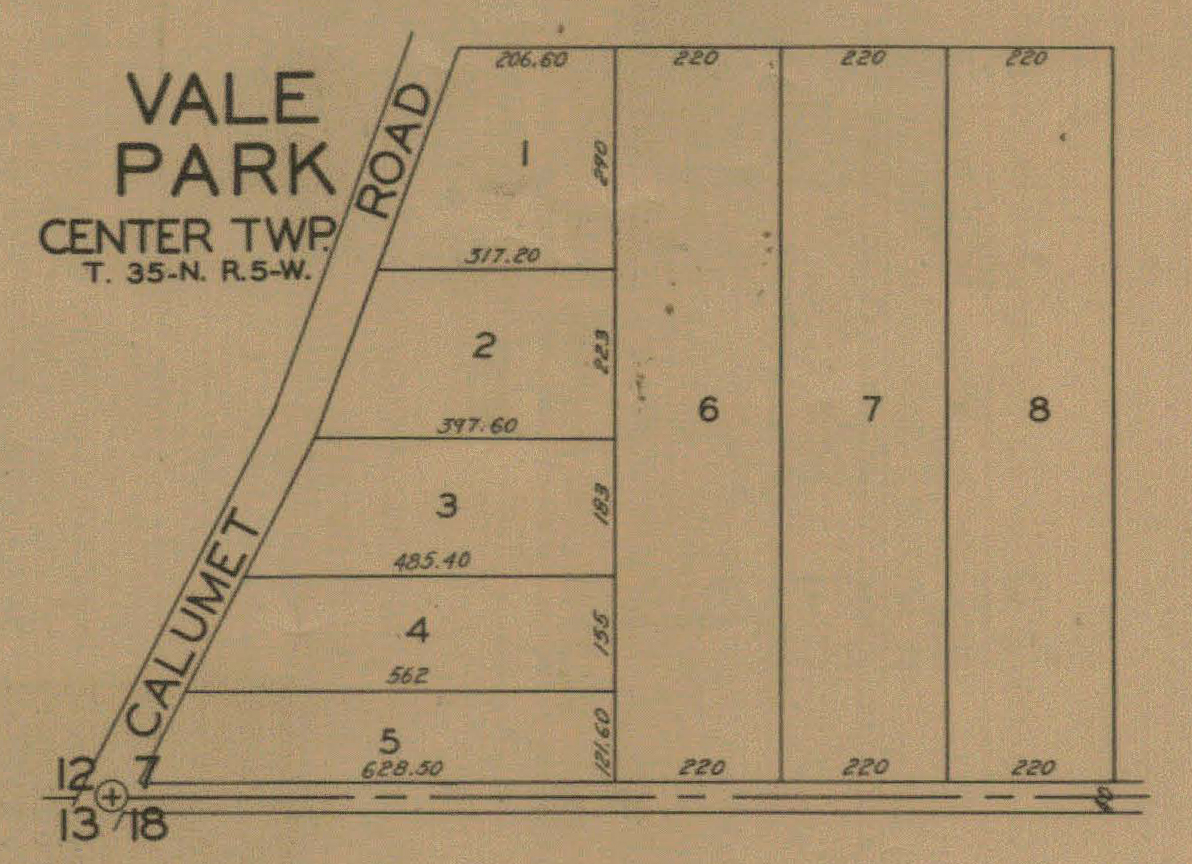
Vale Park, 1921
Vale Park, 1928
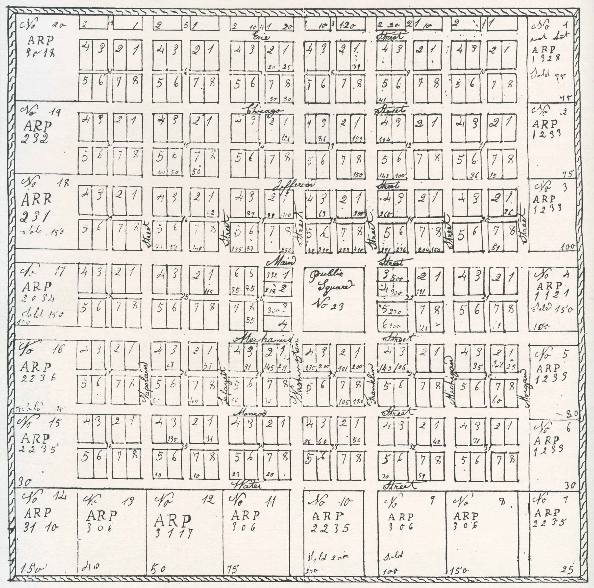
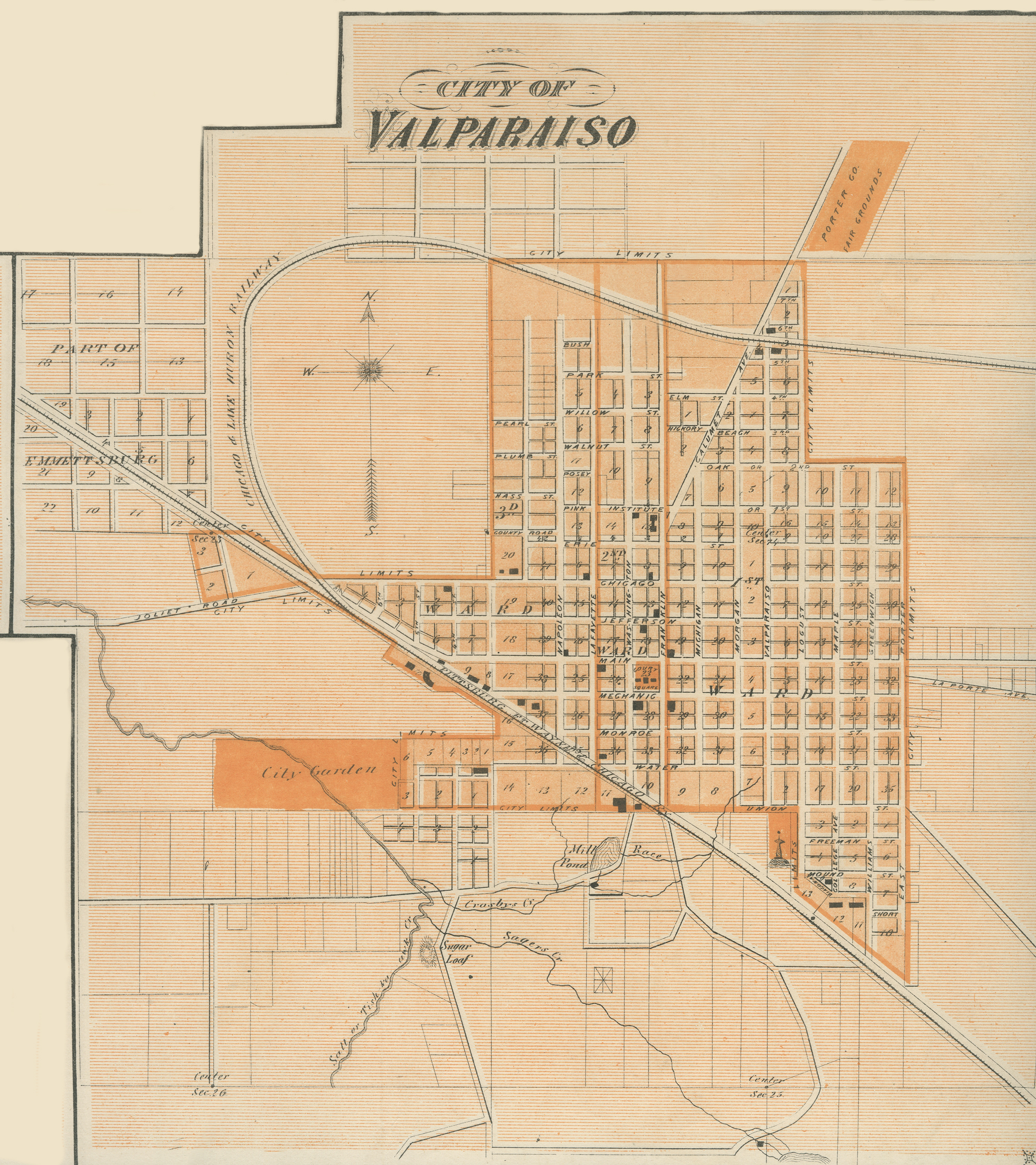
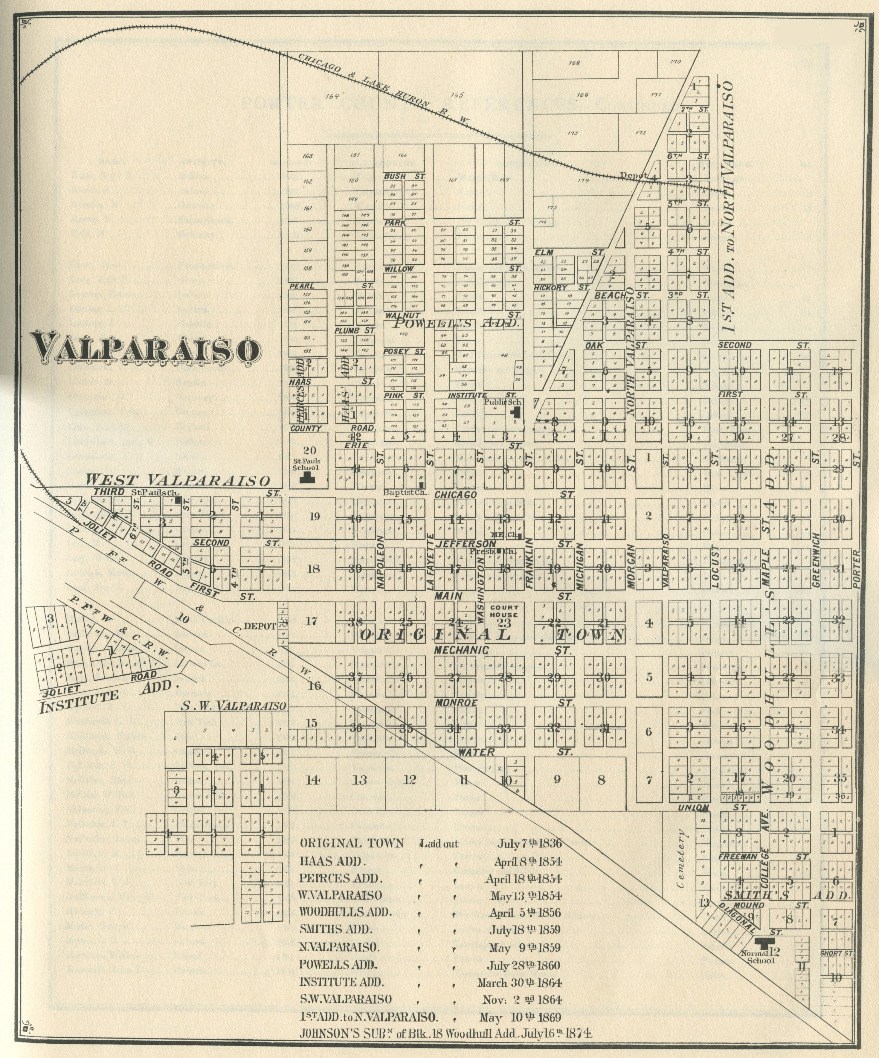
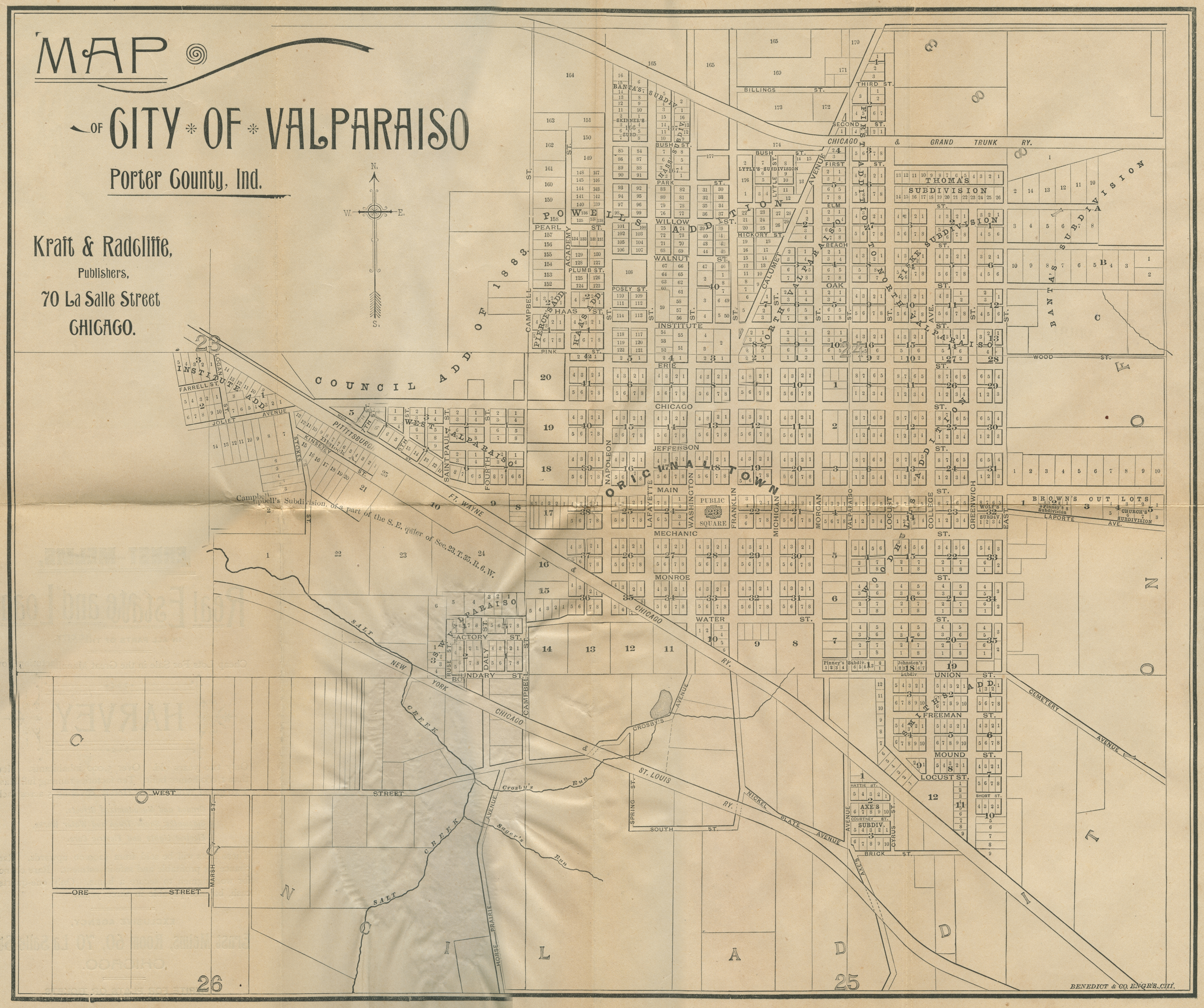
Valparaiso, 1836
Valparaiso, 1837
Valparaiso, 1876 [Indiana Historical Atlas]
Valparaiso, 1876
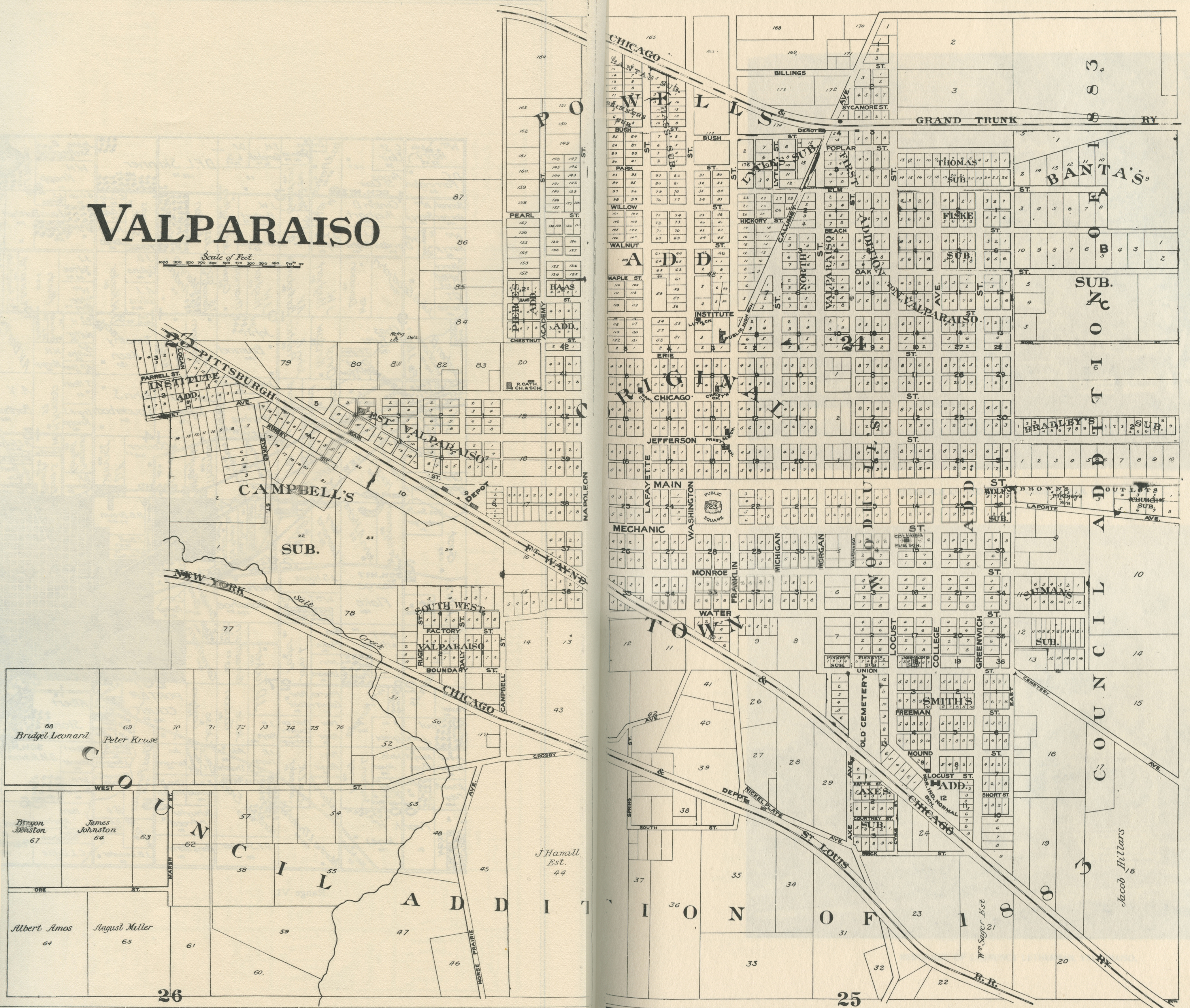
Valparaiso, 1893
Valparaiso, 1895
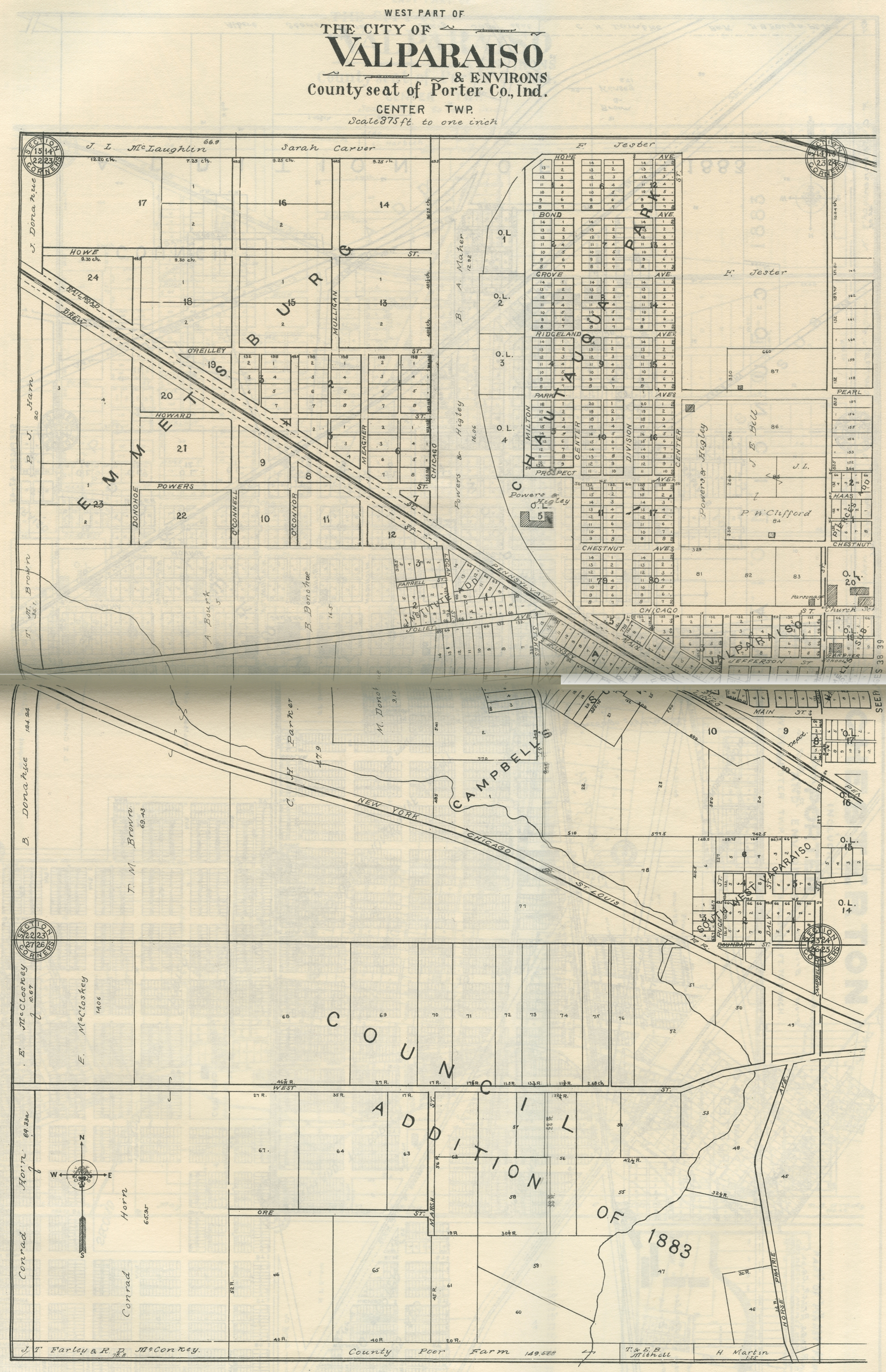
Valparaiso - West Part, 1906
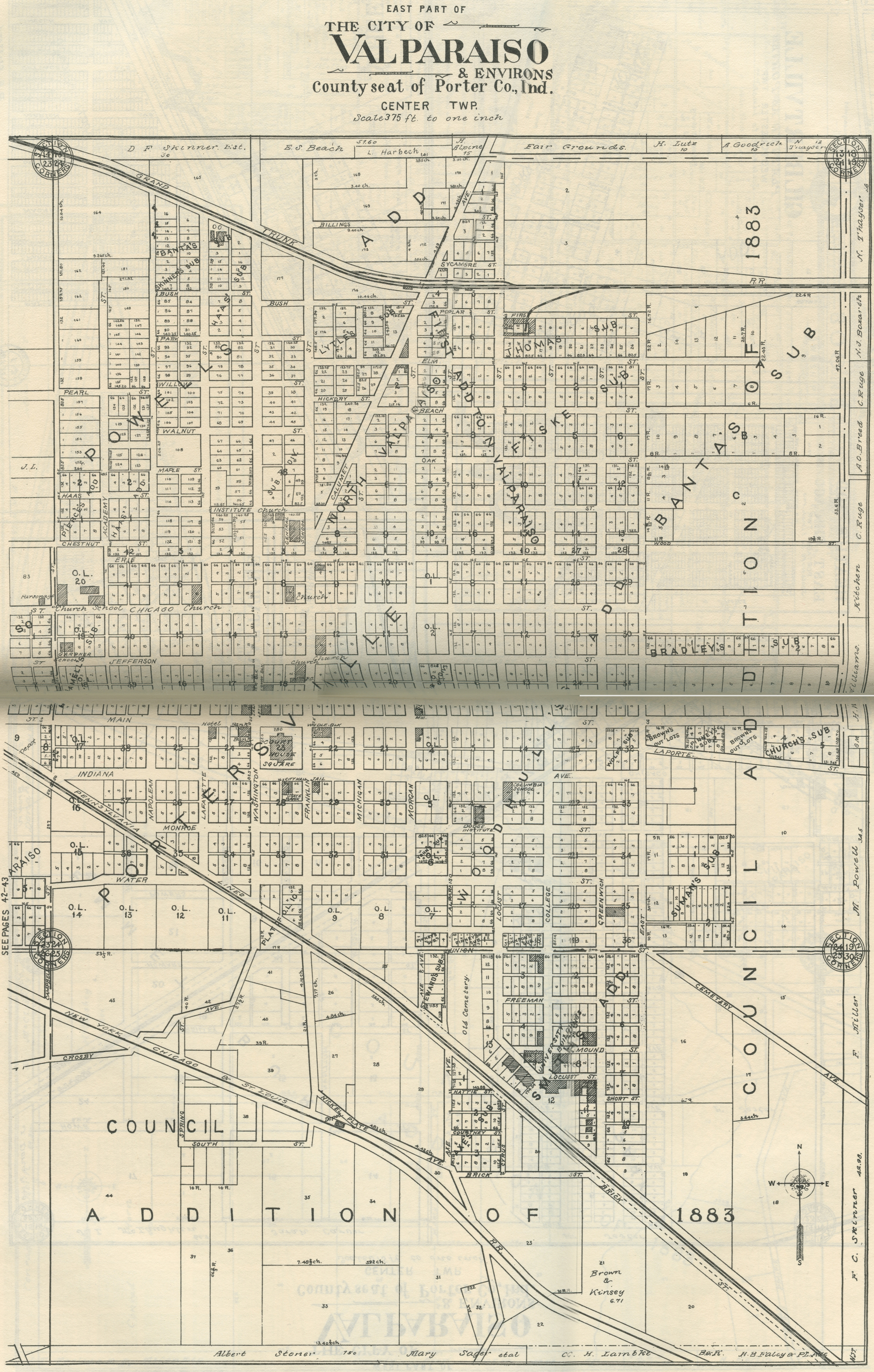
Valparaiso - East Part, 1906
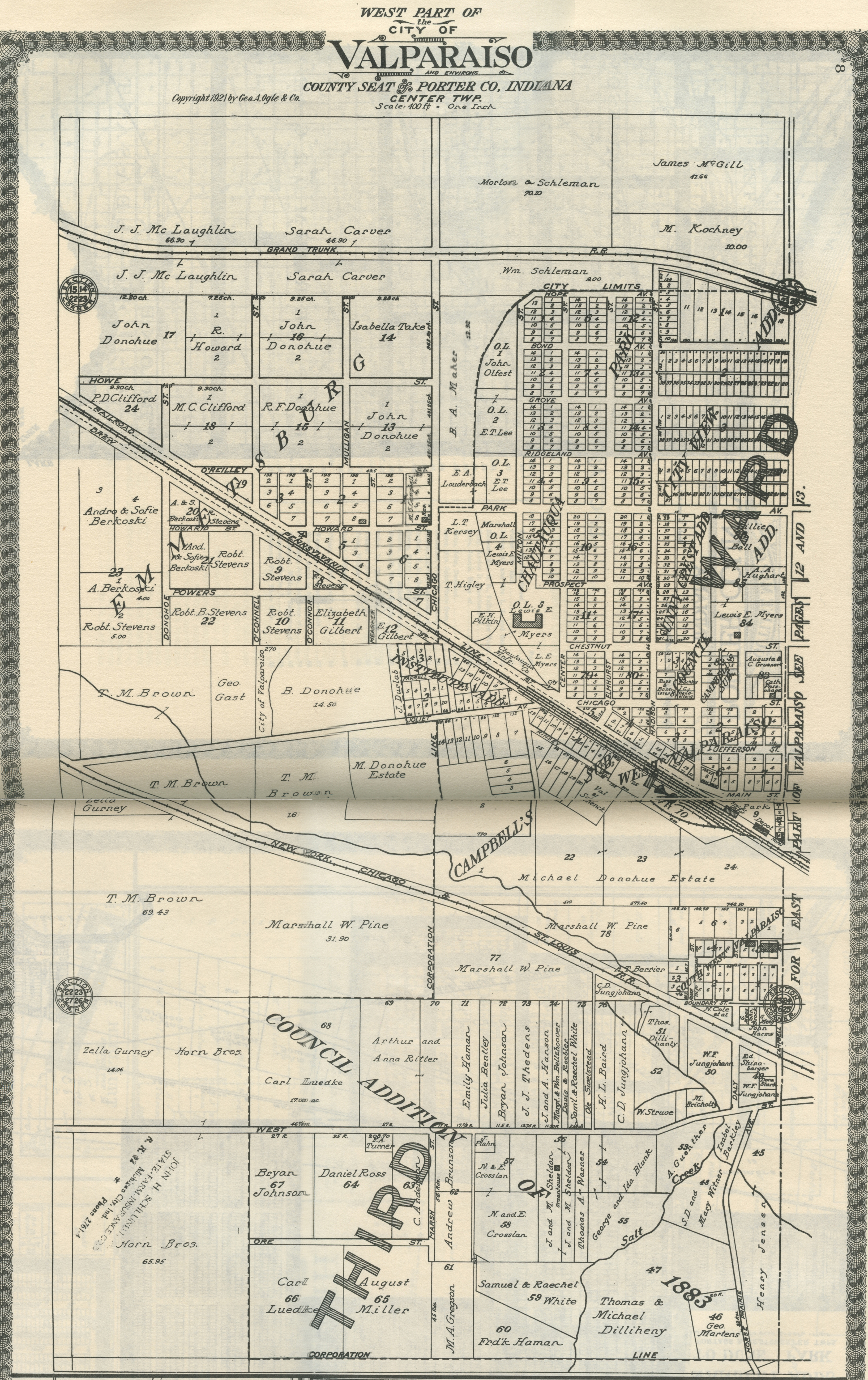
Valparaiso - West Part, 1921
Valparaiso - East Part, 1921
Valparaiso - West Part, 1928
Valparaiso, East Part, 1928
Also see:
1956 Drury's Porter County Aerial Images for Center Township